Unimproved: Land Observation at the Edge of Progress
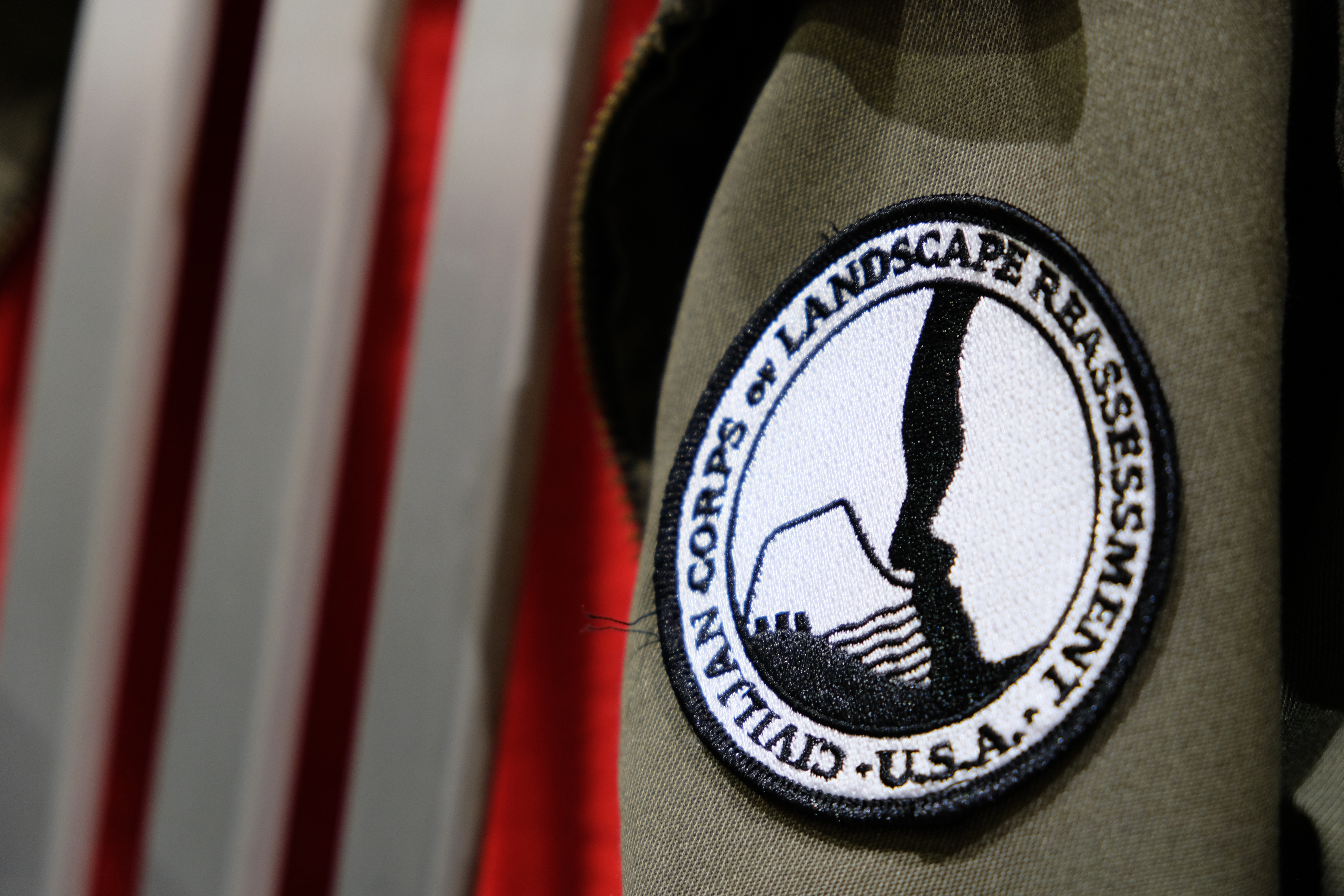
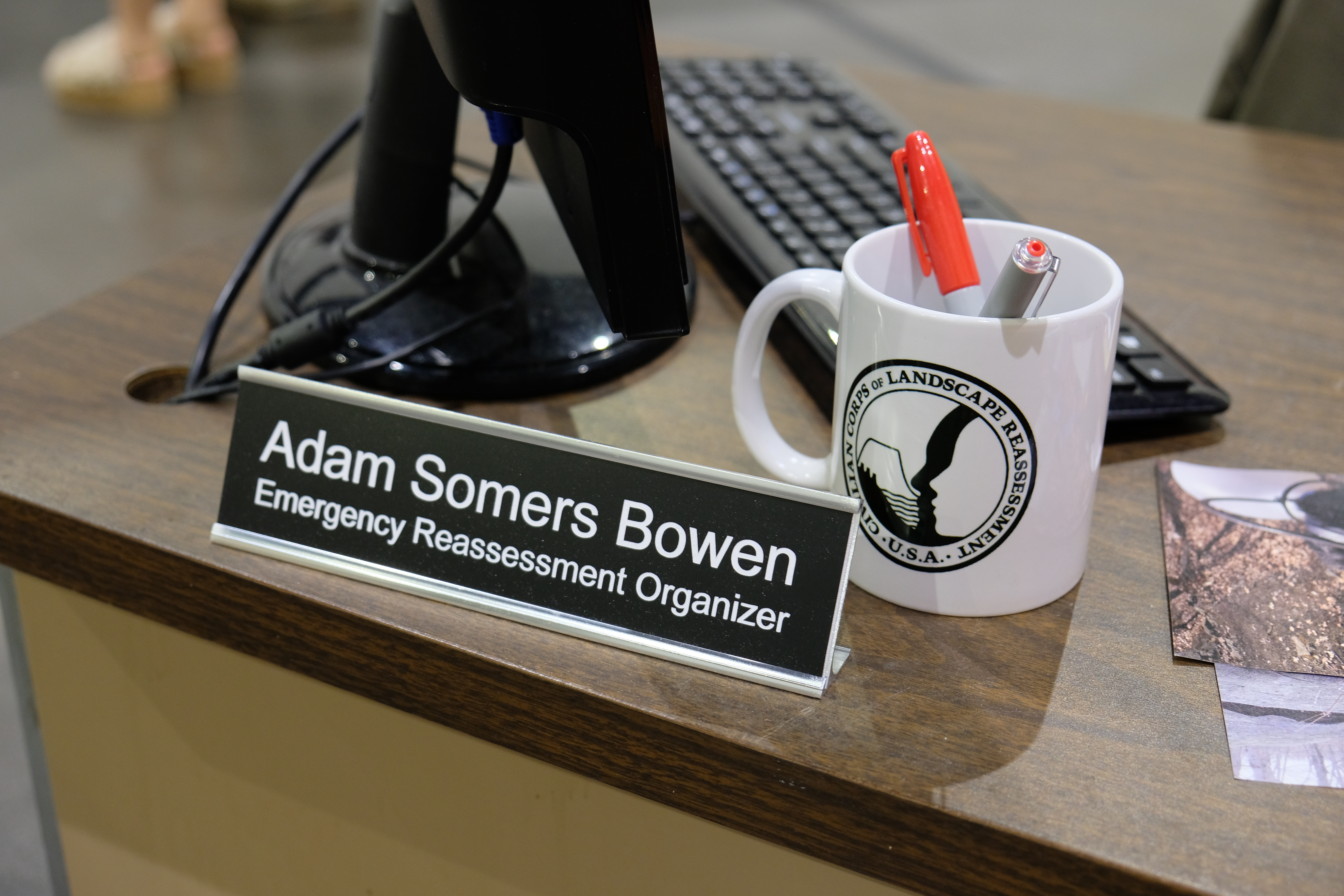
For my thesis project at The Rhode Island School of Design (RISD), I proposed a new wing of the United States Department of the Interior. Civilian Corps of Landscape Reassessment (CCLR) is a fictitious government agency that seeks to address the climate, financial and political threat to US land through a series of citizen designer workshops. It is a means to give citizens a point of access to the discourse and conversation around land issues and create collaboration between citizens and through active participation, increase personal investment.
Find the full text here

ABSTRACT
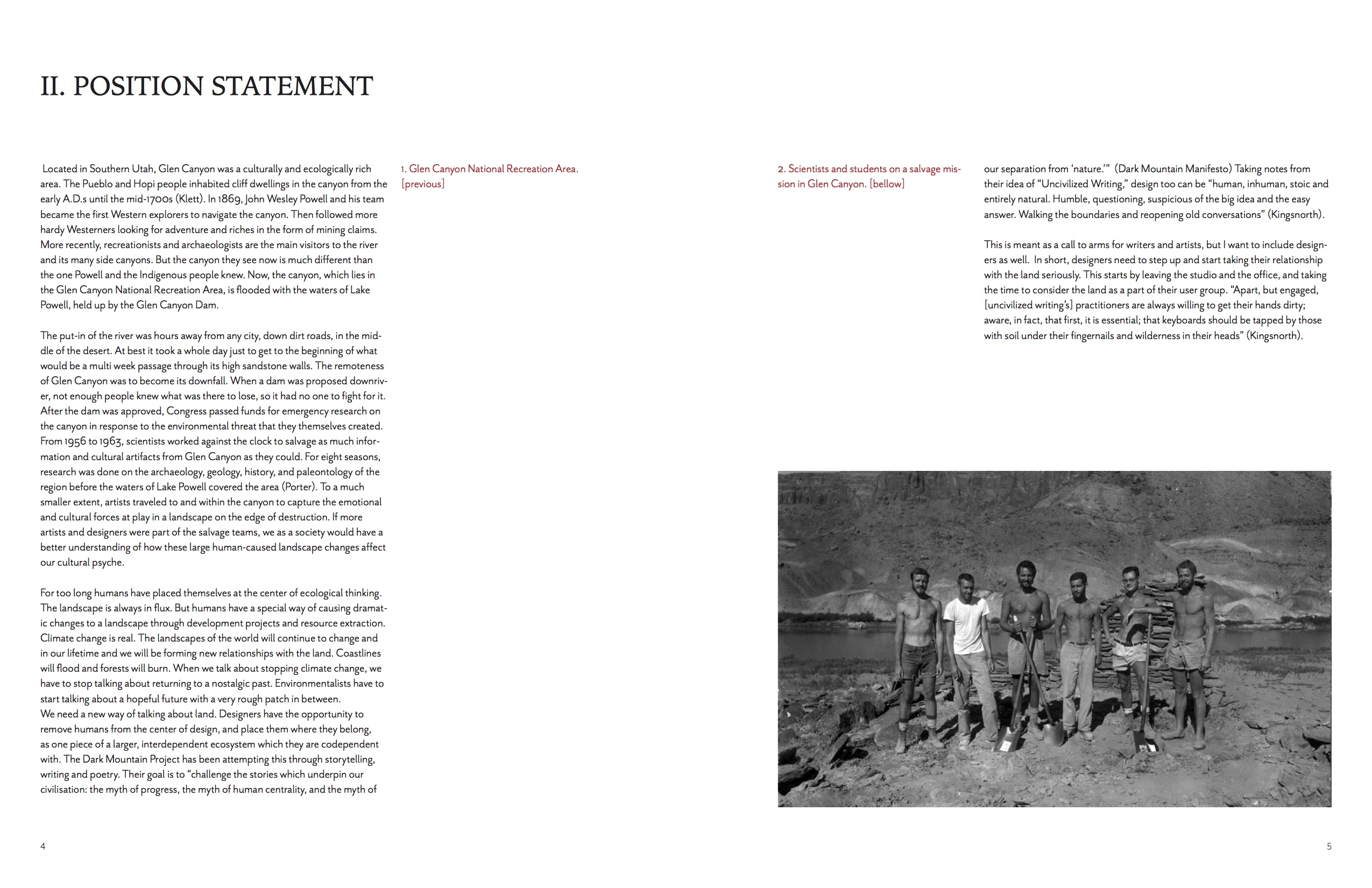
As residents of the United States, all of us have benefited from the resources that this land provides. Some of these resources are responsibly managed, like some logging operations and grazing land. Some are much more harmful, like hydroelectric dams that have drowned Indigenous lands, and block natural habitat. Whether through development or extraction, we as humans have the special ability to drastically change the world around us in a very short amount of time. In a time of rapid environmental change, we need to find ways to better connect, observe, and assess the landscape so that as a society, we can make more informed and compassionate choices on how to manage our shared resources. When we talk about stopping climate change, we have to stop talking about returning to a nostalgic past. We have to start talking about a hopeful but different future with a very rough patch in between.
The United States Federal Government has long mapped, and surveyed the land of this country to promote expansion, extraction, and tourism. I am proposing a set of tools, distributed by a new branch of the Department of the Interior, the Civilian Corps of Landscape Reassessment, as a means to give citizens a point of access to the discourse and conversation around land issues and create collaboration between citizens and through active participation, increase personal investment.
Design Opertunity
I am leveraging individuals’ physical relationships to local landscapes with a design process that is both engaging and creates an emotional investment that goes beyond donating to nonprofits. By capitalizing on history, storytelling and local vernacular, the CCLR will get people excited to be a part of the process of recording landscape and tie it back to a larger whole, that of their local land management issues. It is important to not only get current land users to participate but to entice people who do not see themselves as ‘outdoorsy’ to participate as well.
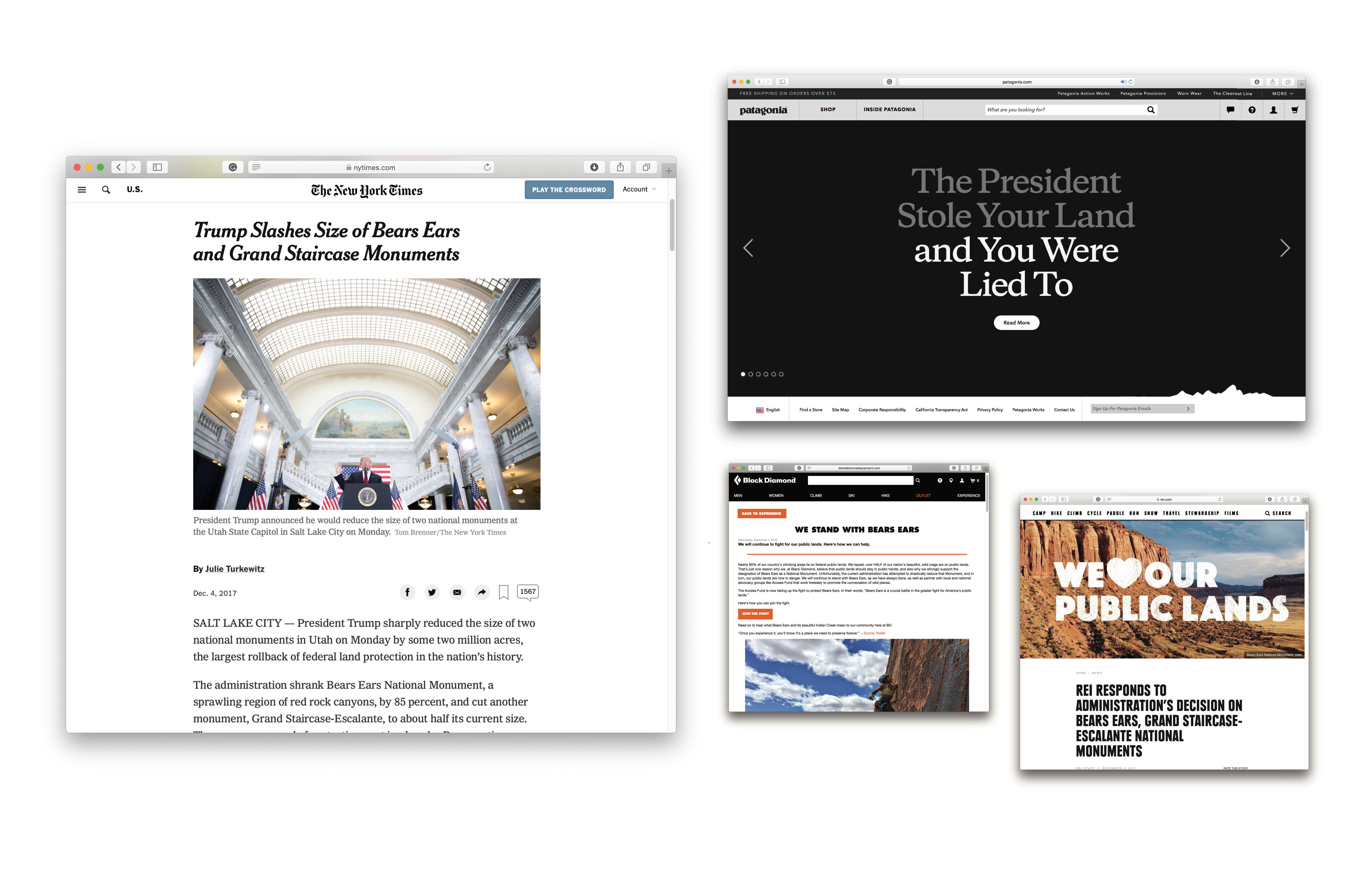
The outdoor industry is quick to denounce any regulations that harms public lands, but does little to offer their customers opportunities for direct action in opposing them.
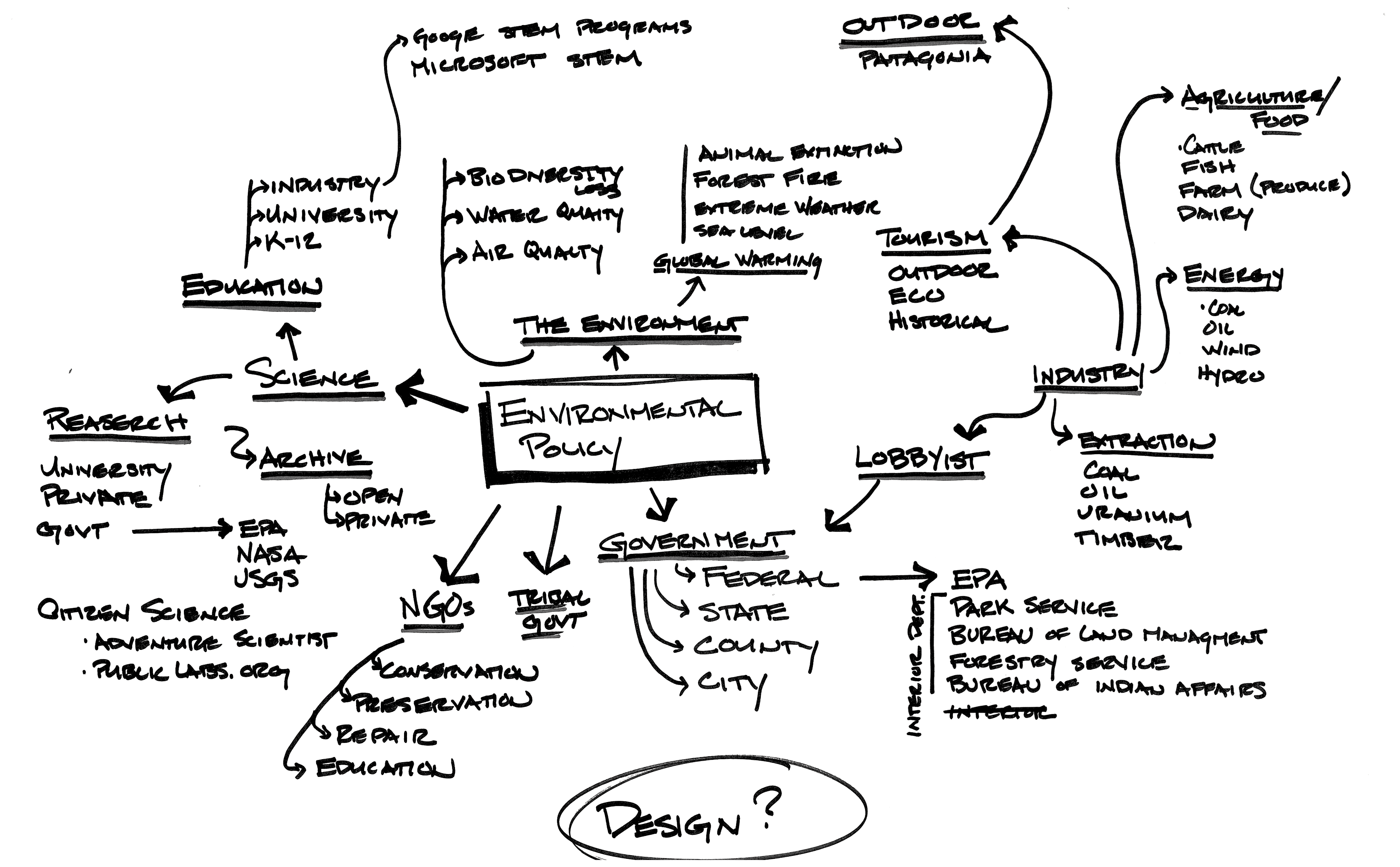
Experiments & Workshops
Various techniques were deployed to understand how users relate to their natural surroundings as well as potential technologies that could be used.
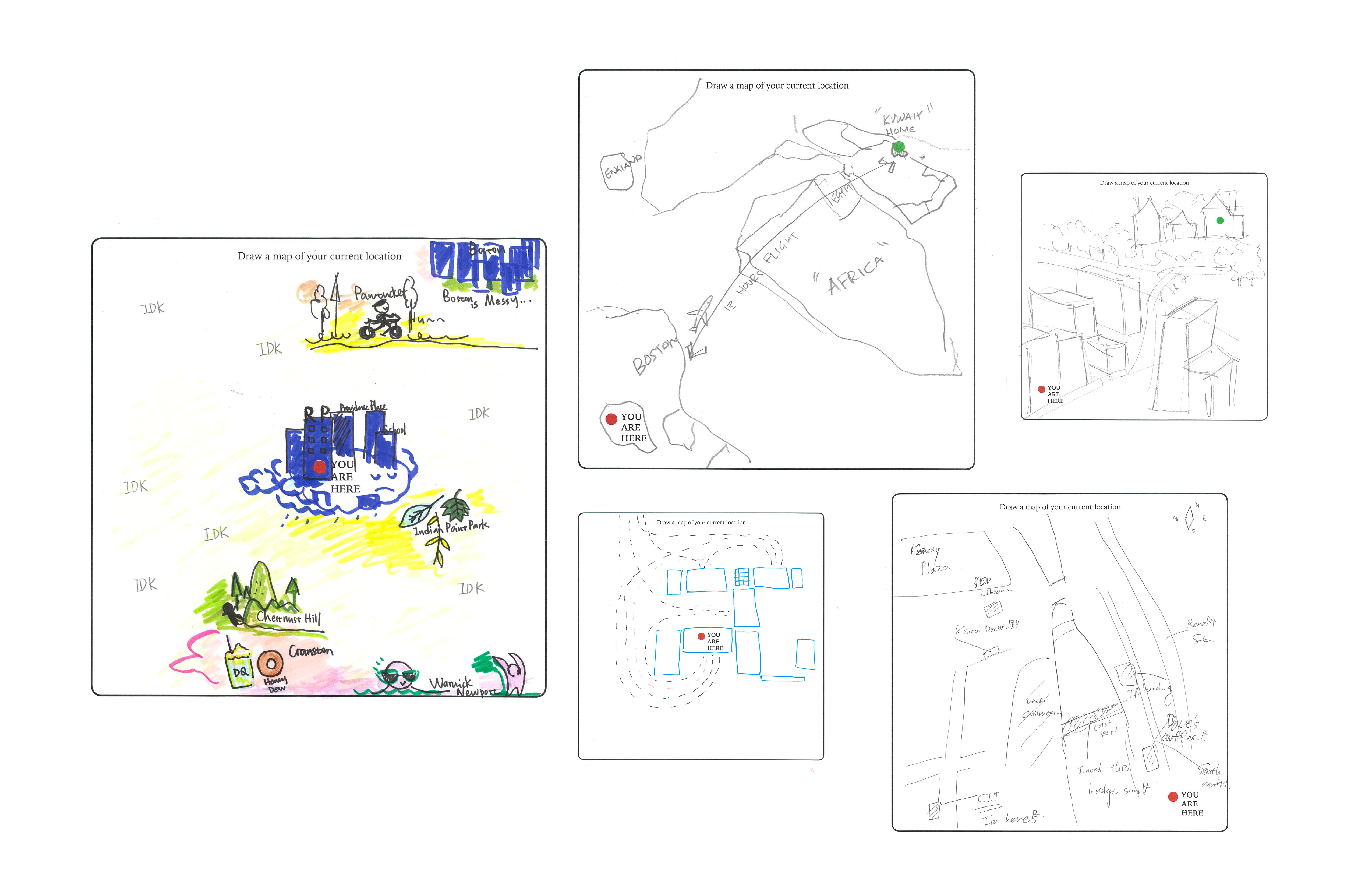
MAPPING WORKSHOP
I wanted to see how residents of cities see themselves in relation to their world. Do they have an understanding of the land around them, and to what extent? There have to be features that they use to navigate and use to place themselves in their world. I wonder if it would be possible to get back to the storytelling and local knowledge style of wayfinding we relied upon before the ‘matter-of-fact’ directions that you get from a GPS.
These mapping exercises have the ability to pull out of people their opinions and view of the place in a much more casual, conversational way than just looking over a pre-drawn map. We need to once again go beyond the limits of reason to speak about the places we live.
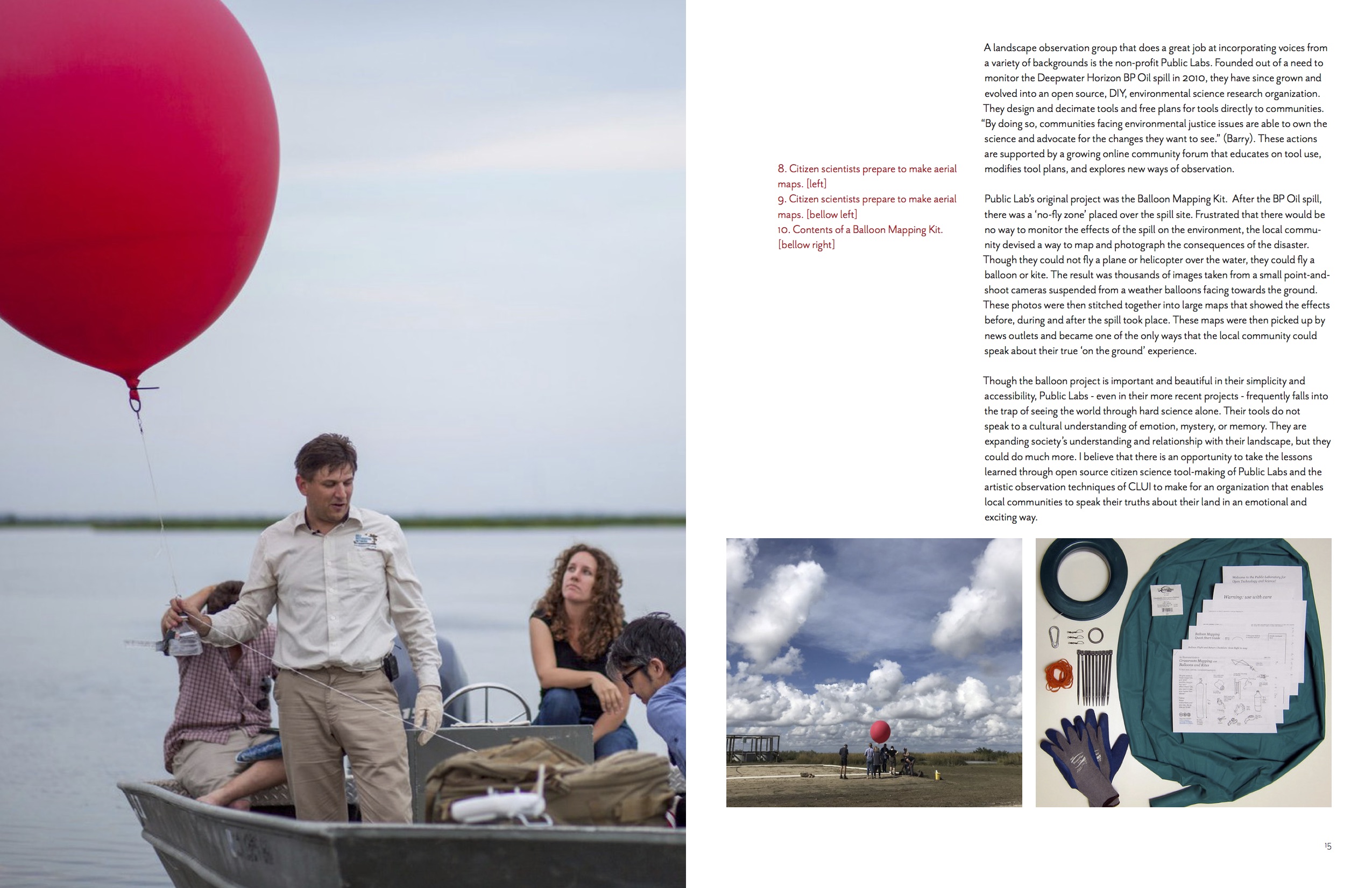
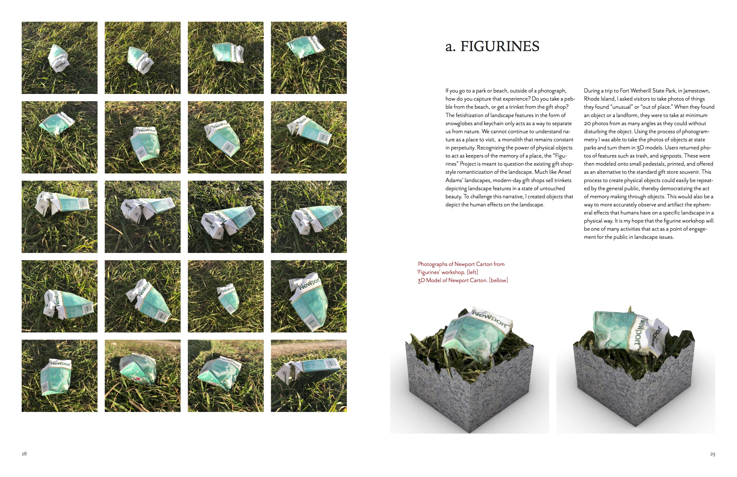
FIGURINES WORKSHOP
Recognizing the power of physical objects to act as keepers of the memory of a place, the “Figurines” Project is meant to question the existing gift shop- style romanticization of the landscape.
I asked visitors to take photos of things they found “unusual” or “out of place.” When they found an object or a landform, they were to take at minimum 20 photos from as many angles as they could without disturbing the object. Using the process of photogrammetry I was able to take the photos of objects at state parks and turn them in 3D models. These were then modeled onto small pedestals, printed, and offered as an alternative to the standard gift store souvenir. This process to create physical objects could easily be repeat- ed by the general public, thereby democratizing the act of memory making through objects. It is my hope that the figurine workshop will be one of many activities that act as a point of engagement for the public in landscape issues.


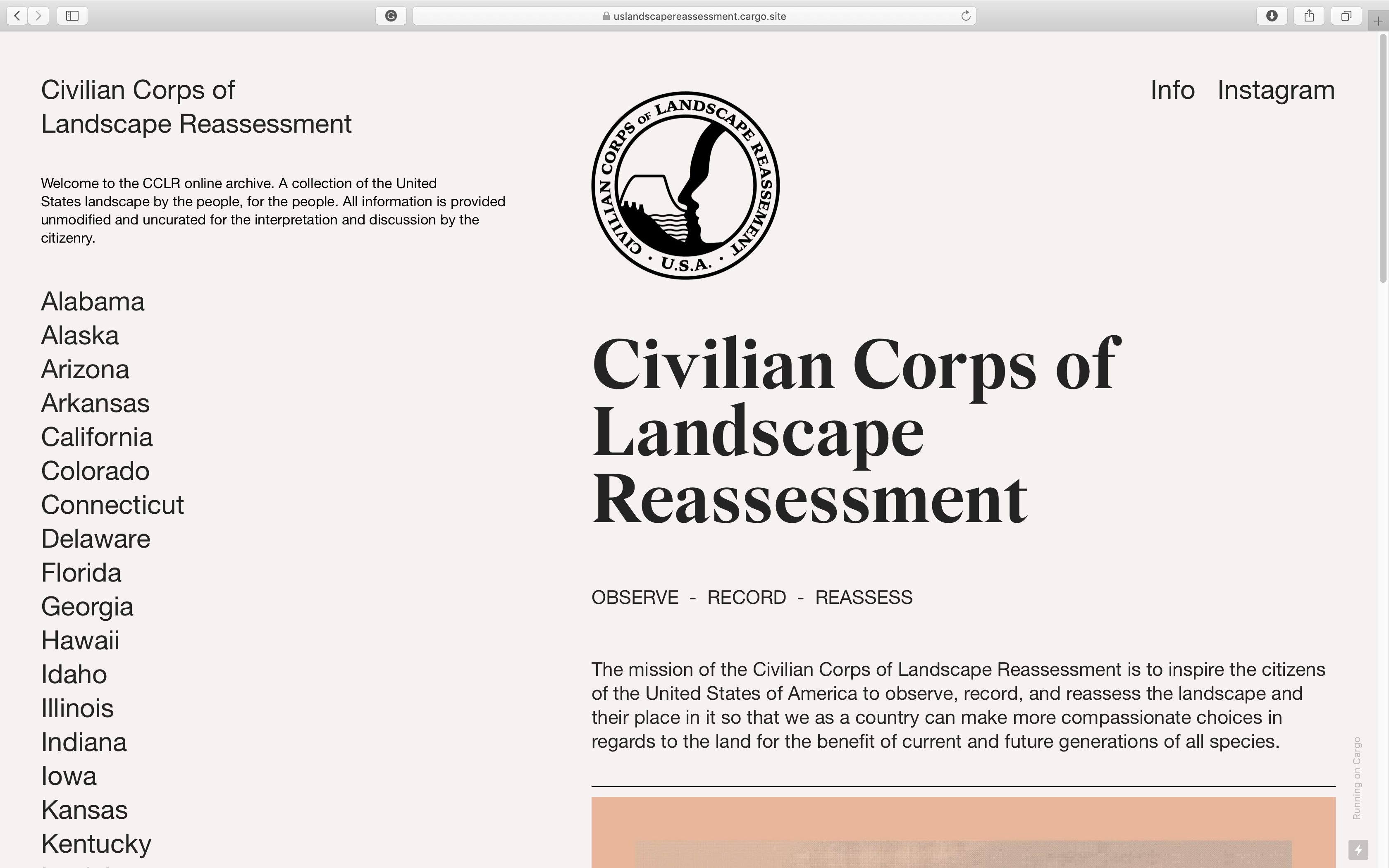
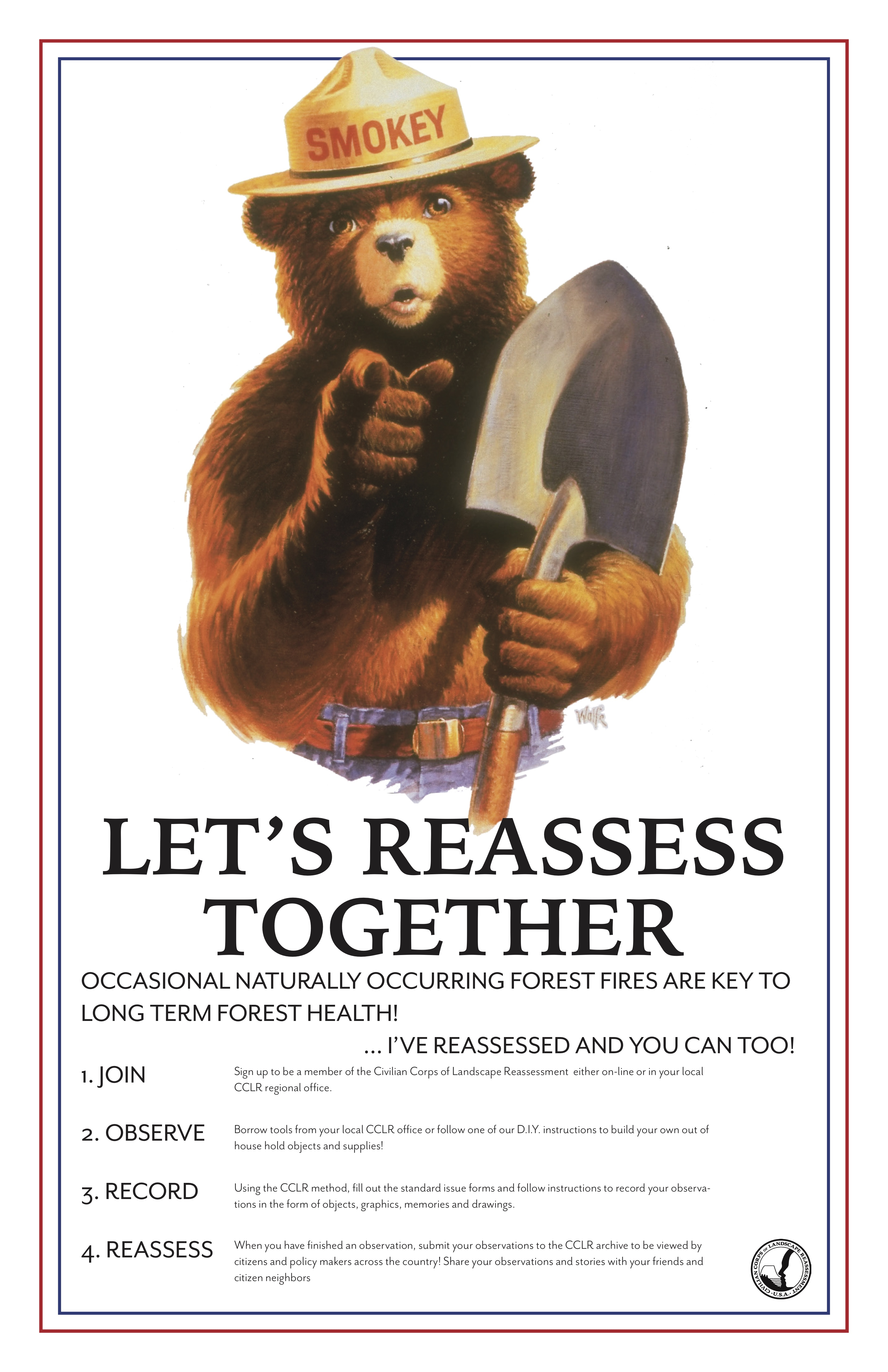
CIVILIAN CORPS OF LANDSCAPE REASSESSMENT
The mission of the Civilian Corps of Landscape Reassessment is “to inspire the citizens of the United States of America to observe, record, and reassess the landscape and their place in it, so that we as a country can make more compassionate choices in regards to the land for the benefit of current and future generations of all species.”
By using an object based design fiction framework, I am inviting participants to unteather themselves from their current understanding of the world and explore a new future. The Corps grounds that fiction in a singular scenario.
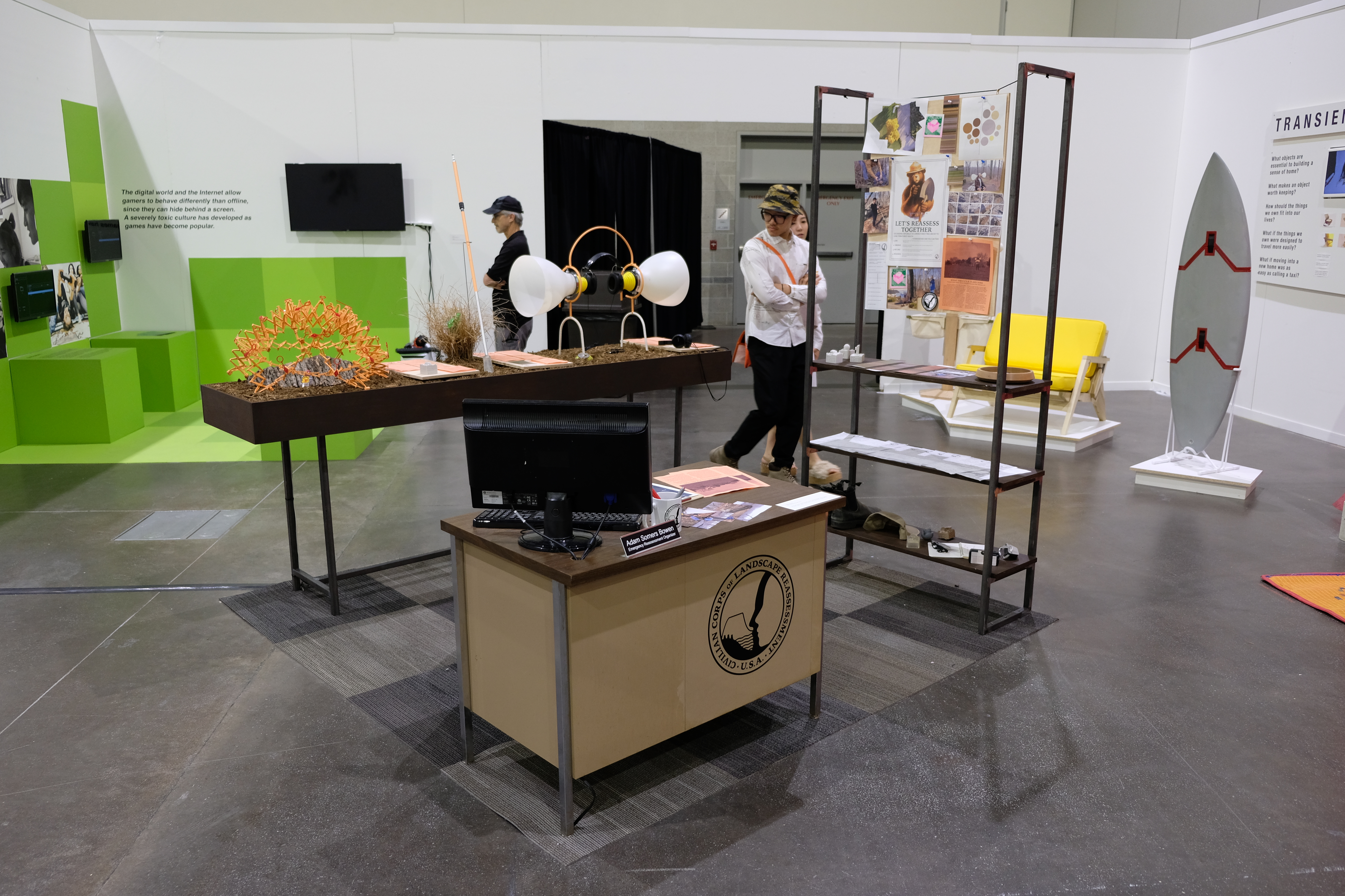
Tools
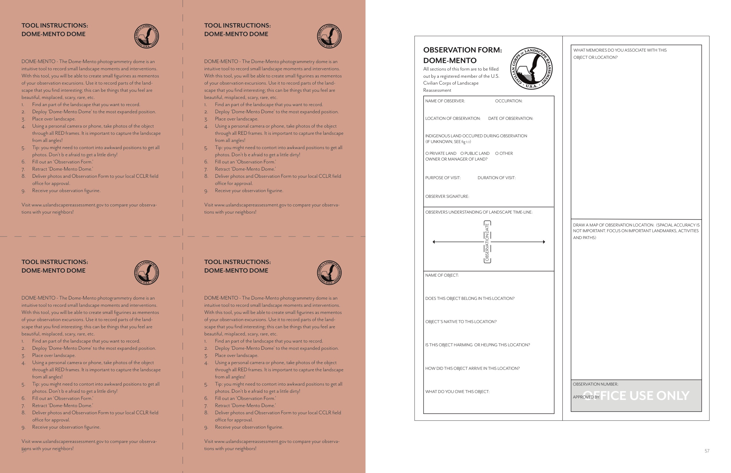
It is important to note that these tools are not trying to solve any one problem in particular. They instead act as a new lens to view, understand, and interpret your own local landscape. These tools vary in application and the data recorded, but all ask the user to show up in a different way to their environment and reconsider how they experience the world around them. Along with these tools, citizens are asked to fill out forms to go with their observations. Here I am trying to bring out storytelling and emotion. What are you hearing? Why is it making this sound and how does it make you feel? These answers, along with the artifacts, will then be cataloged and available for review. Together, with their neighbors, local citizens will have the opportunity to reflect on their experience and relationship with their local environment.
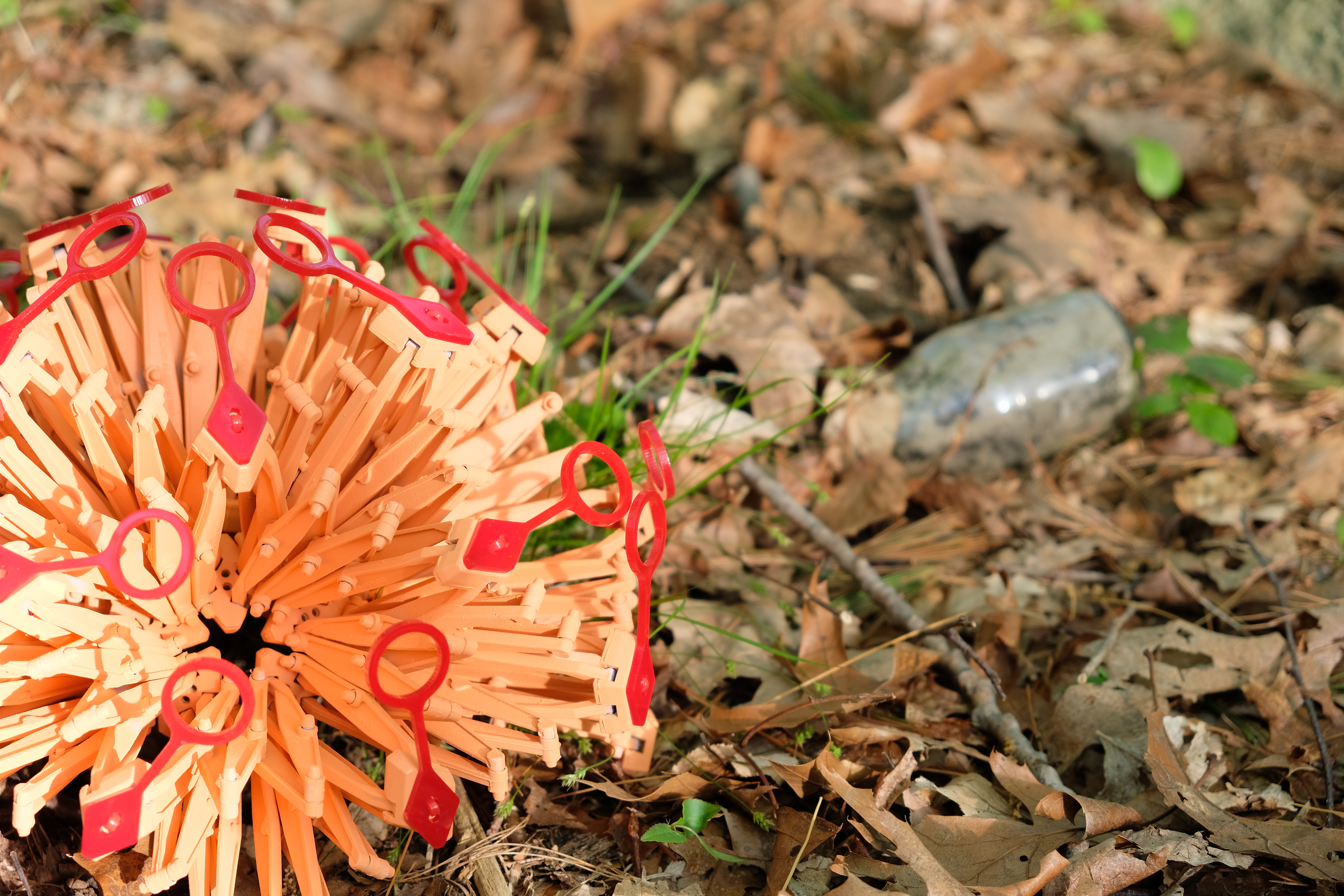
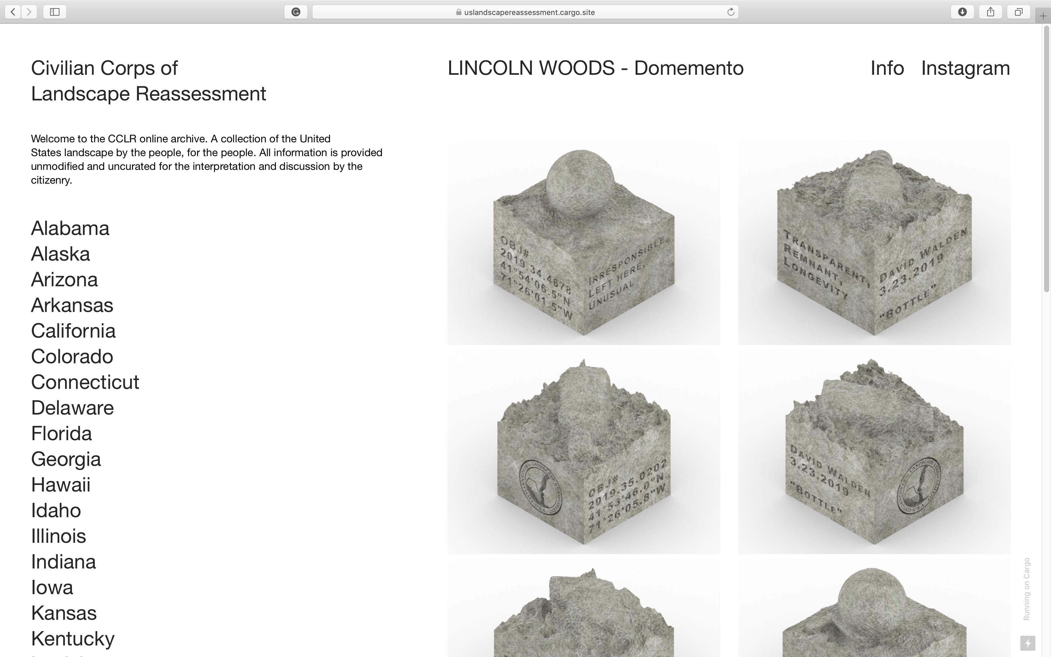
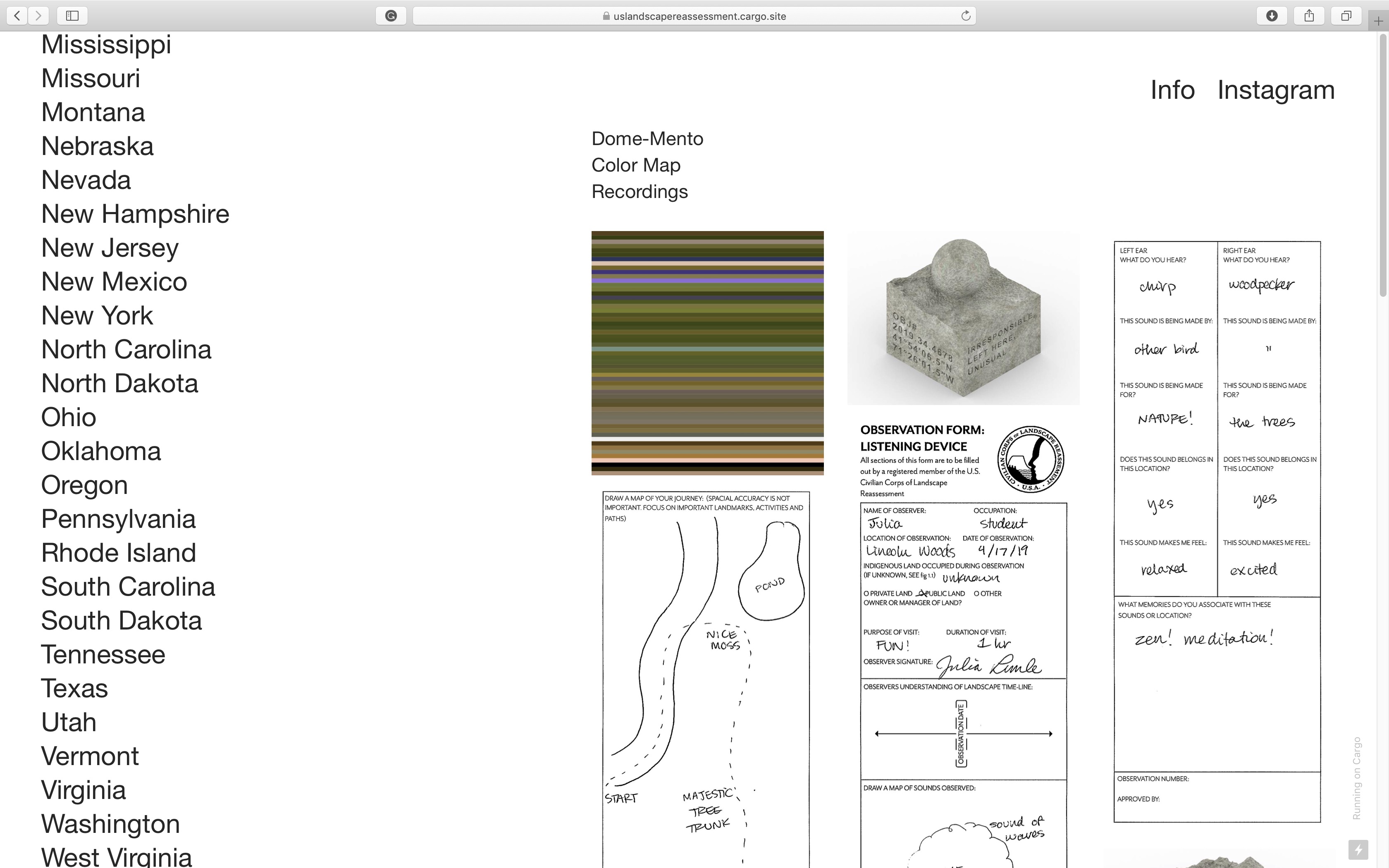
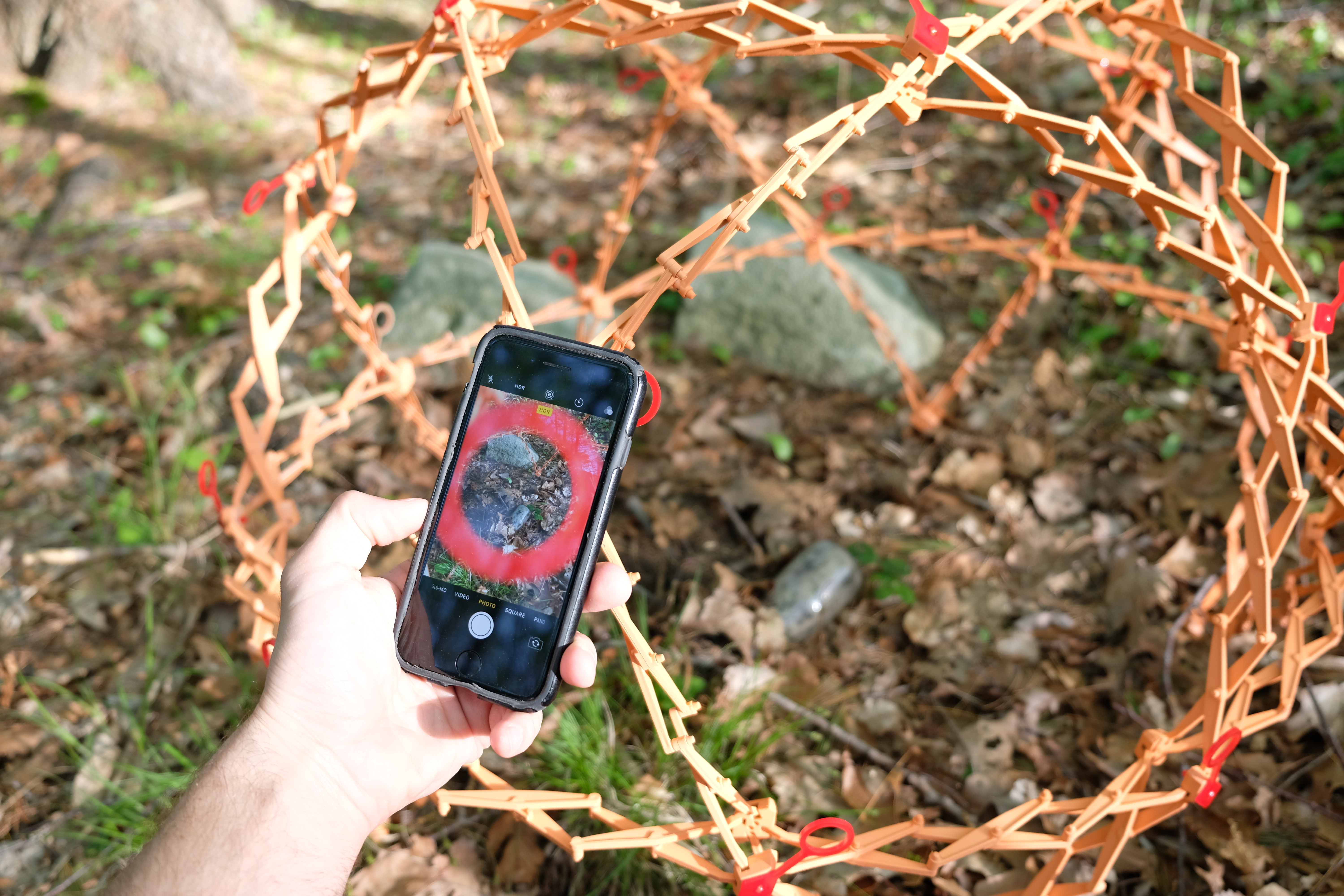
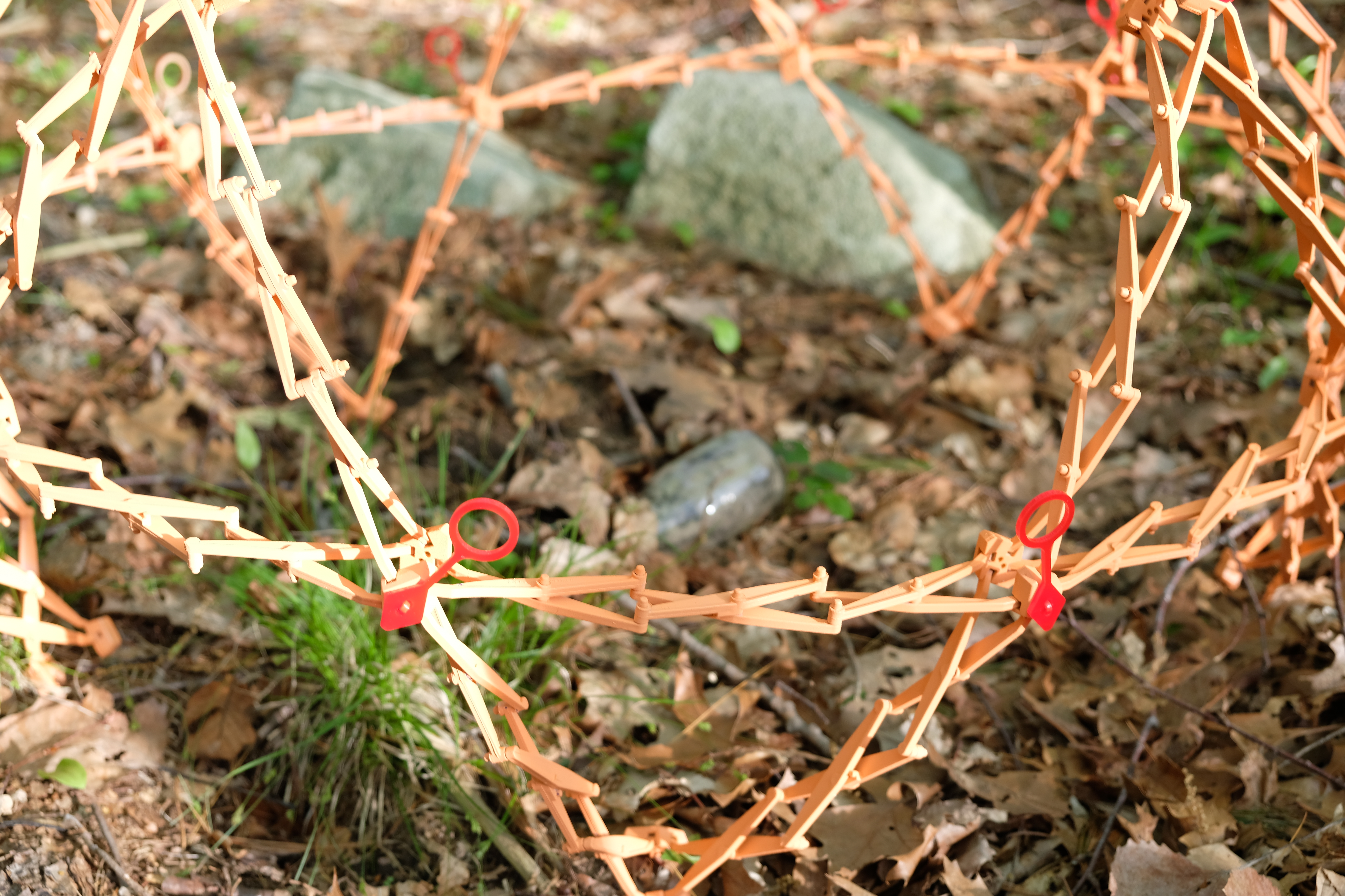
DOME-MENTO
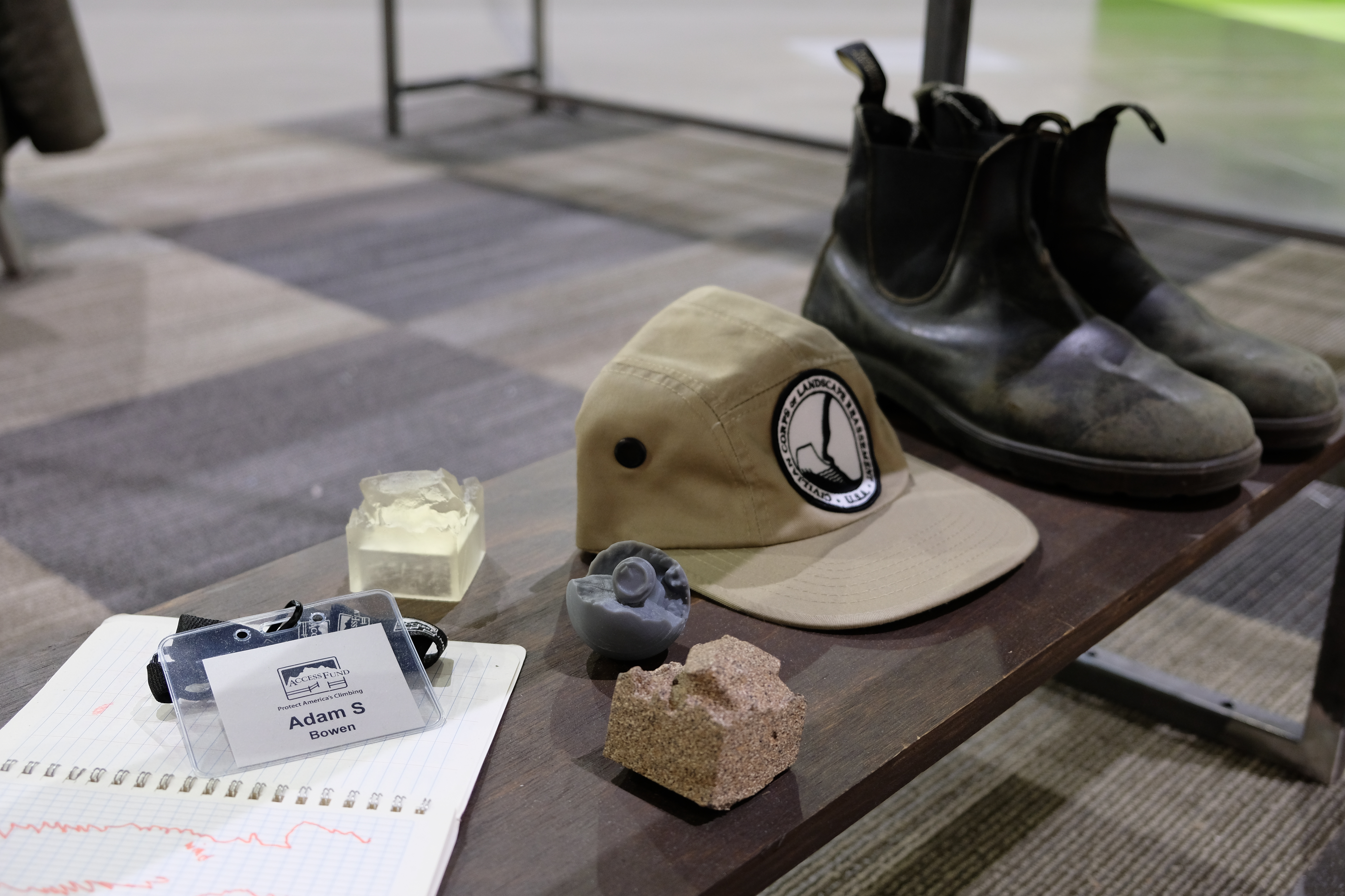
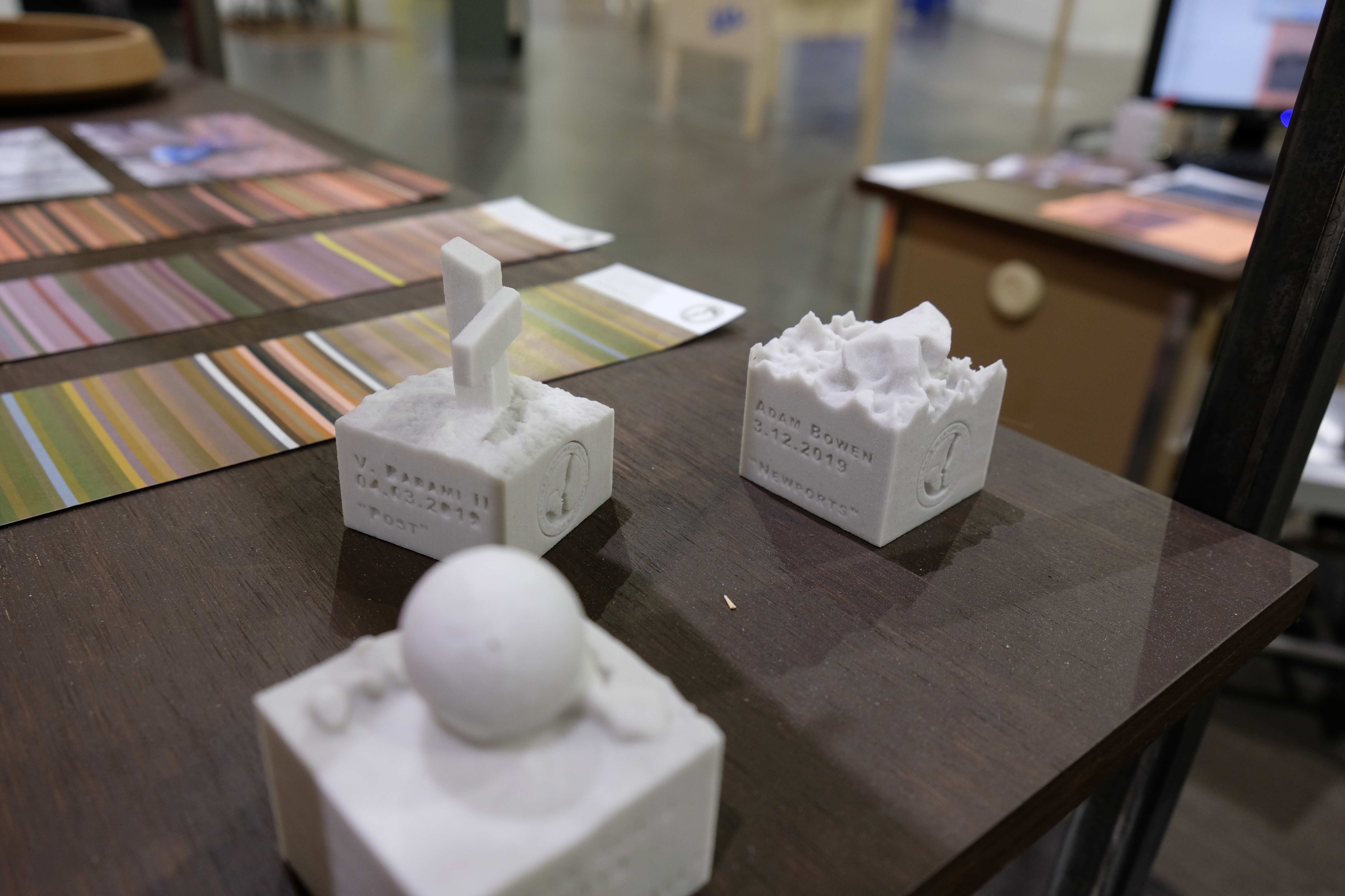
The first tool that the Corps offers is a portable photogrammetry dome. Constructed from a modified Hoberman dome, the Dome-Mento Dome is an expanding dome that is lightweight and portable, but also large and stable when expanded. At each of the 19 nodes of the dome, is a portal for users to frame their photographs. Using a camera, users have to move to each node and photograph the object of choice. This process ensures that there will be a complete set of photographs, evenly spaced and of consistent distance from the object that will be used to create the three-dimensional mesh. More importantly, though, it forces the user to take time with the object that they are recording. They are made to consider the object from all angles, not just one or two positions. With the array of photos created, the three-dimensional model is created and printed out of sandstone. This artifact is printed in duplicate. One for the Corps Archive and one for the observer. This trinket is not only proof of service, but a physical container of memory for that citizen observer and a point of discussion with their fellow land users.
The first tool that the Corps offers is a portable photogrammetry dome. Constructed from a modified Hoberman dome, the Dome-Mento Dome is an expanding dome that is lightweight and portable, but also large and stable when expanded. At each of the 19 nodes of the dome, is a portal for users to frame their photographs. Using a camera, users have to move to each node and photograph the object of choice. This process ensures that there will be a complete set of photographs, evenly spaced and of consistent distance from the object that will be used to create the three-dimensional mesh. More importantly, though, it forces the user to take time with the object that they are recording. They are made to consider the object from all angles, not just one or two positions. With the array of photos created, the three-dimensional model is created and printed out of sandstone. This artifact is printed in duplicate. One for the Corps Archive and one for the observer. This trinket is not only proof of service, but a physical container of memory for that citizen observer and a point of discussion with their fellow land users.

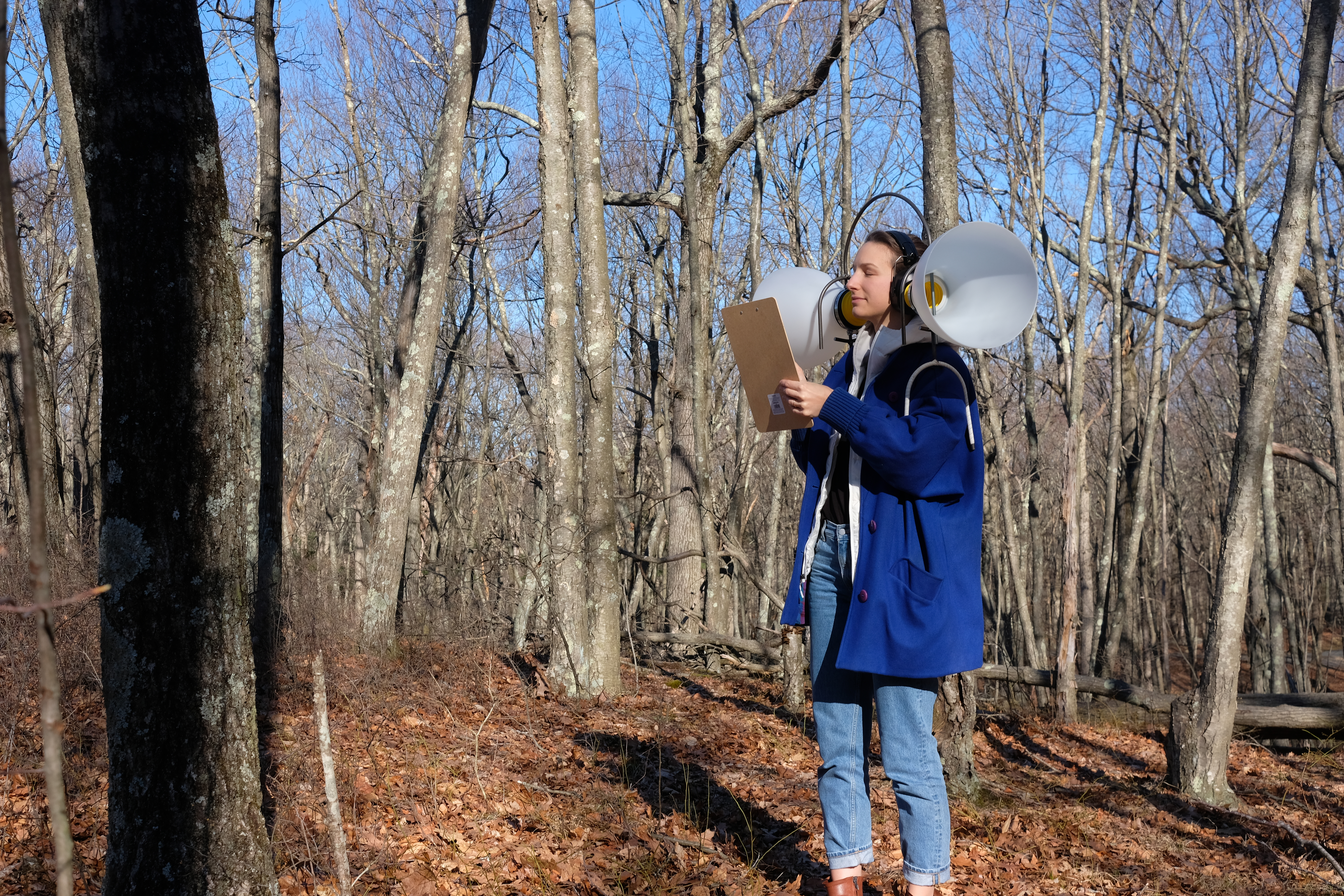
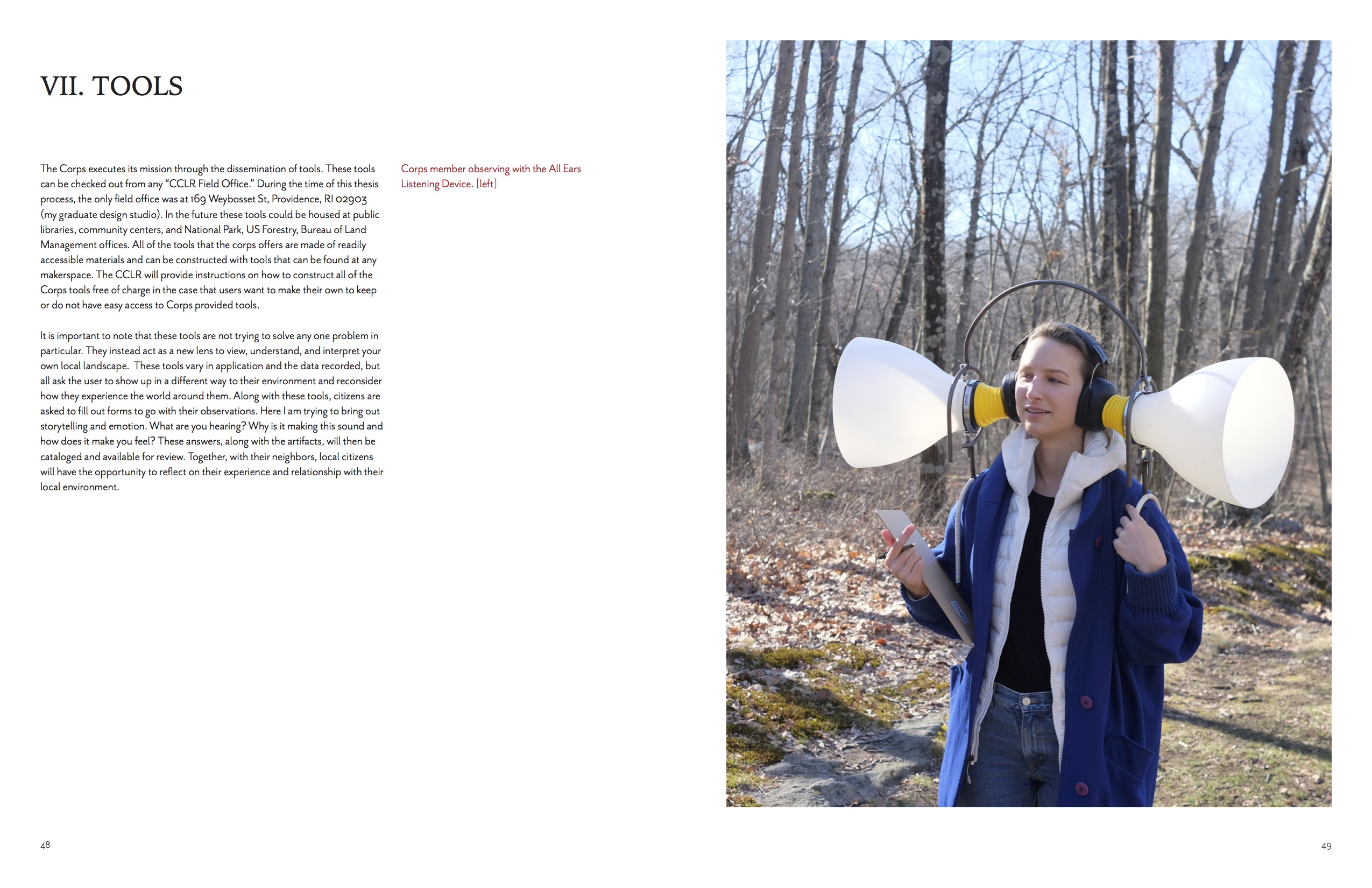
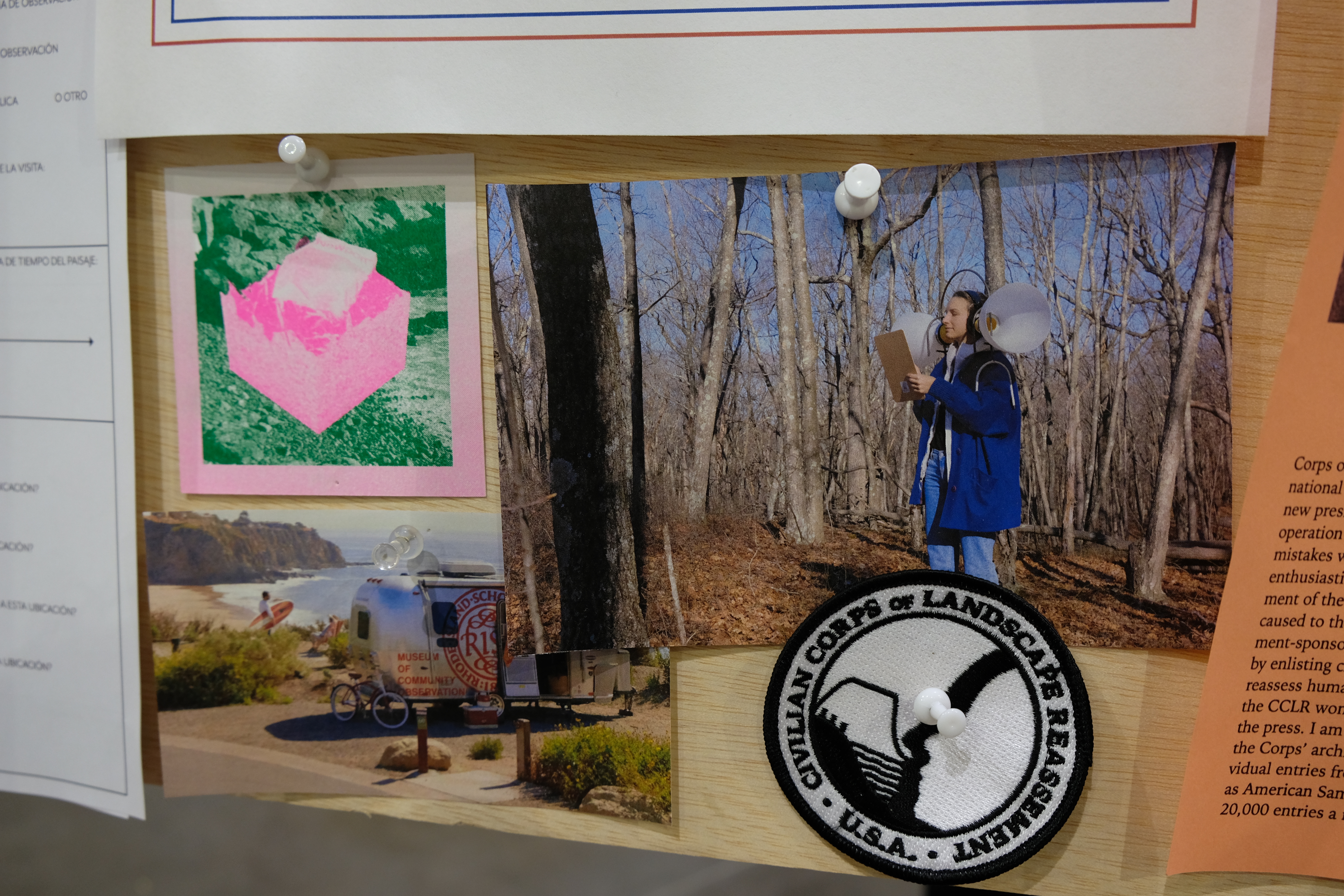
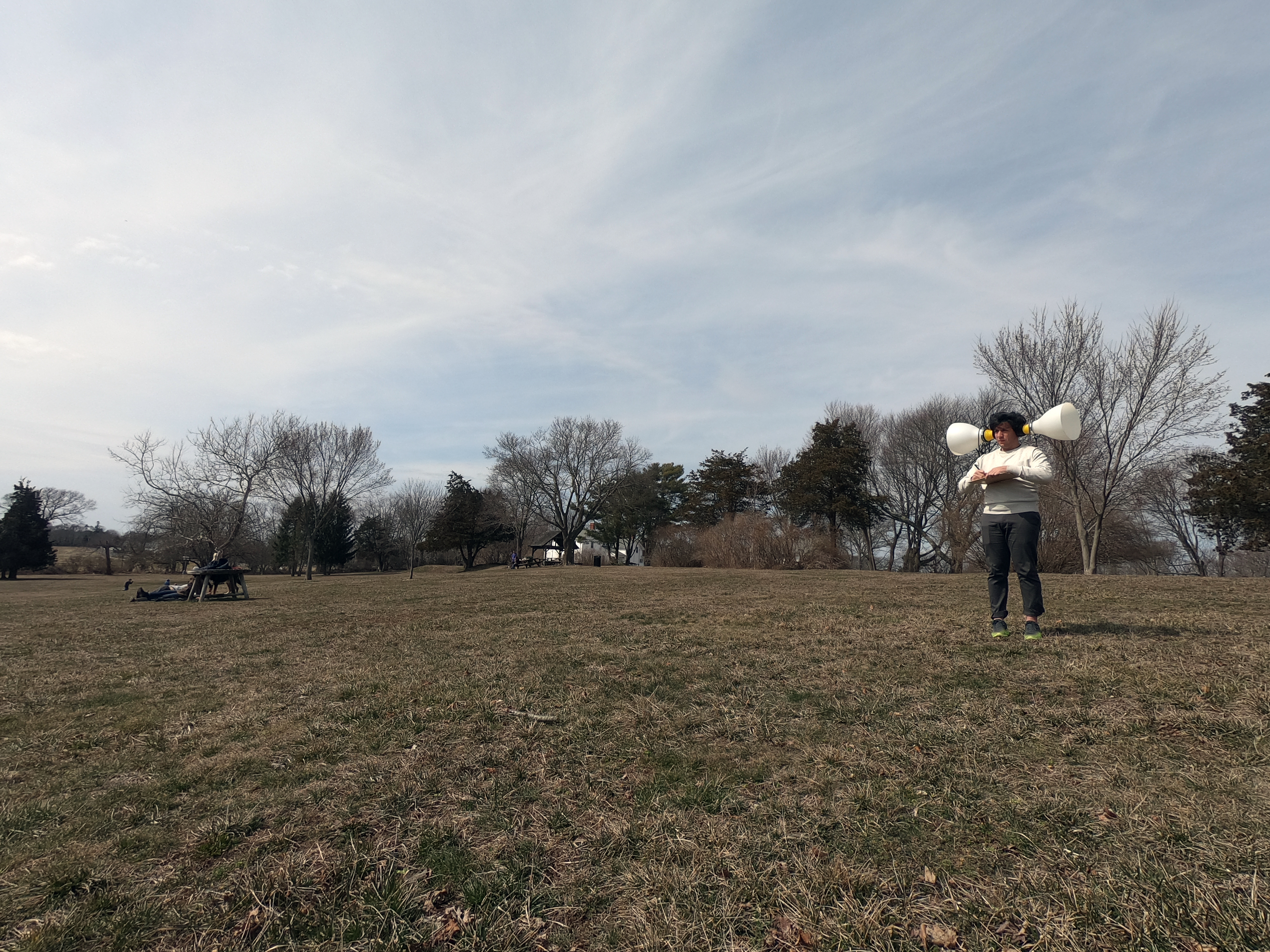
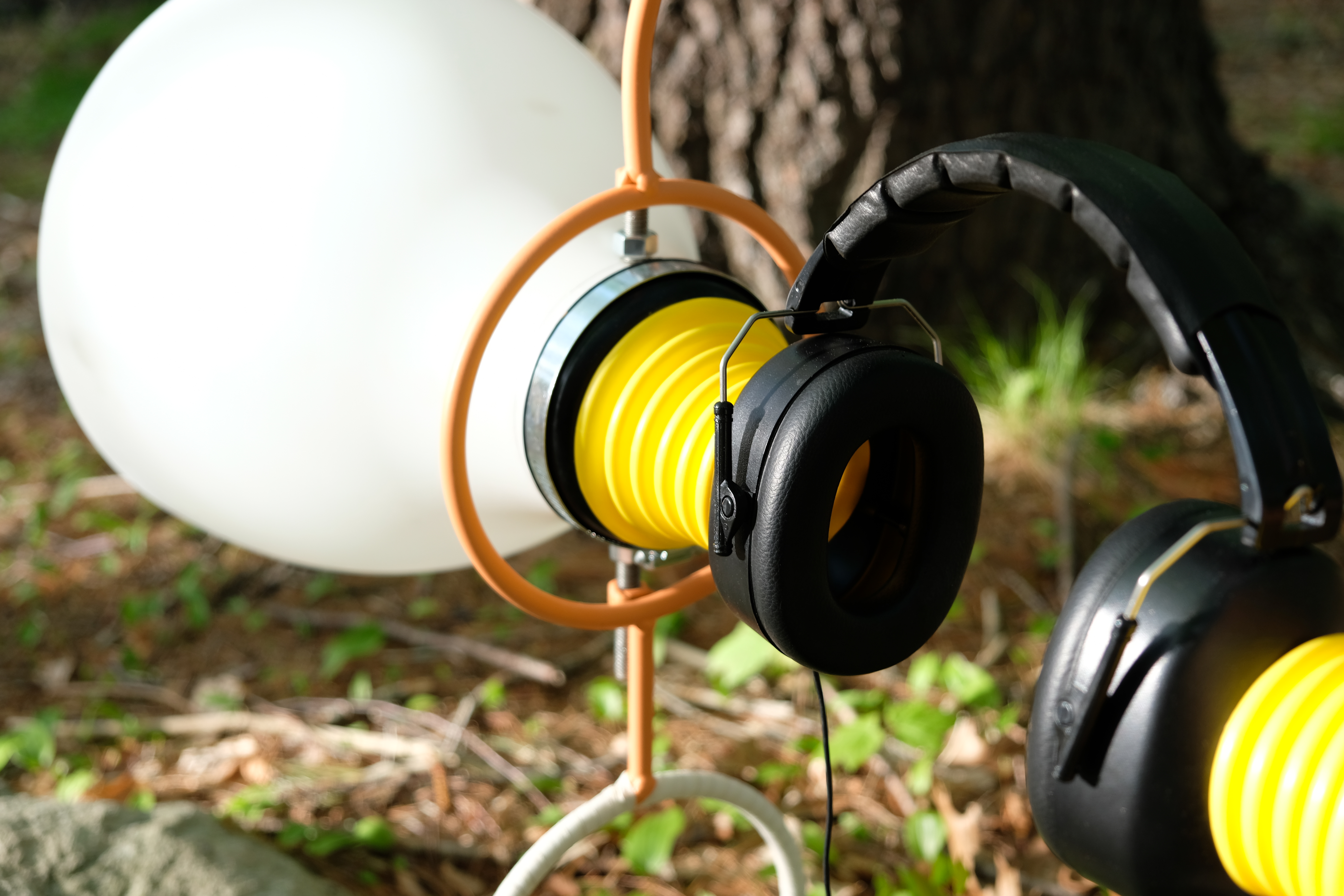
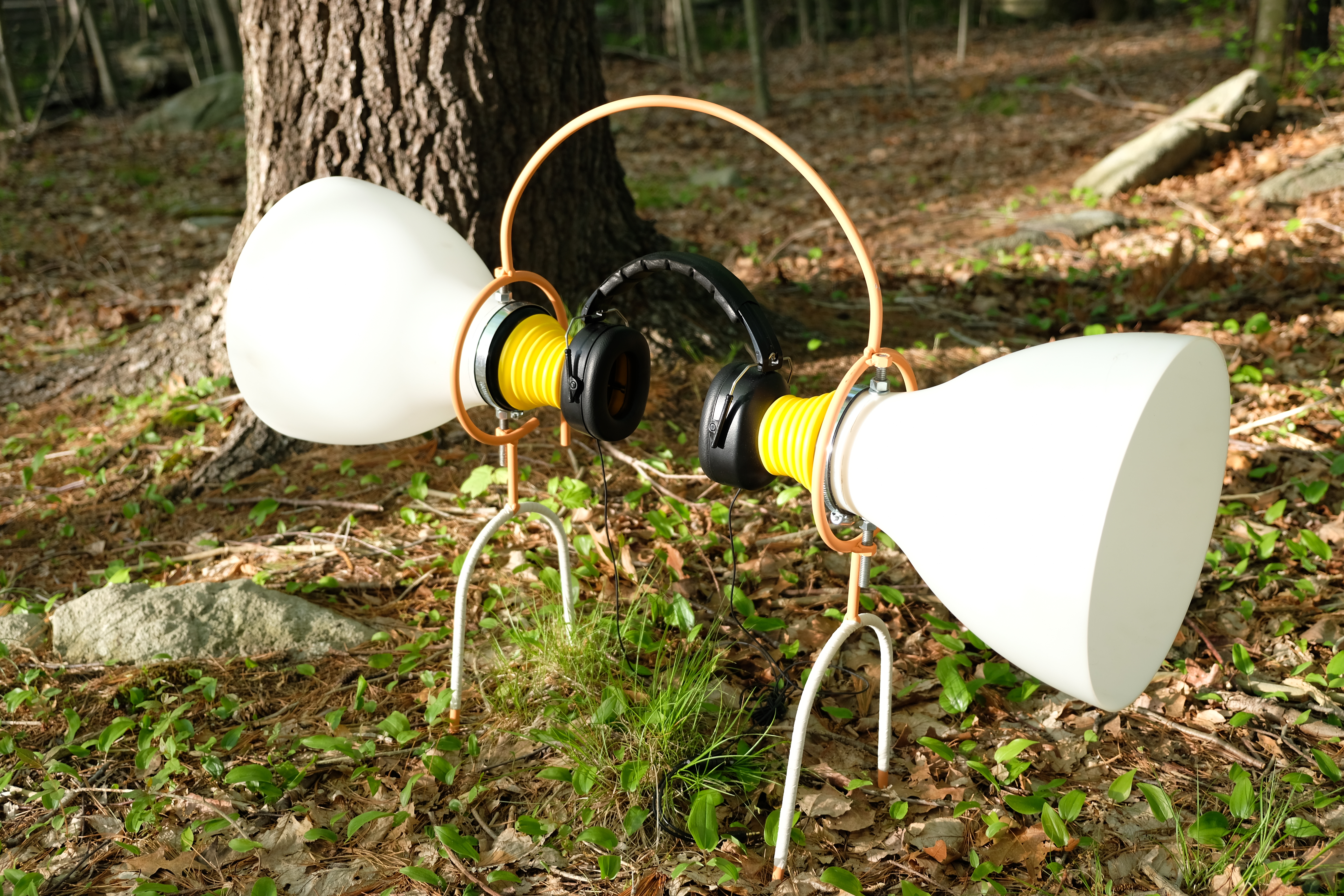
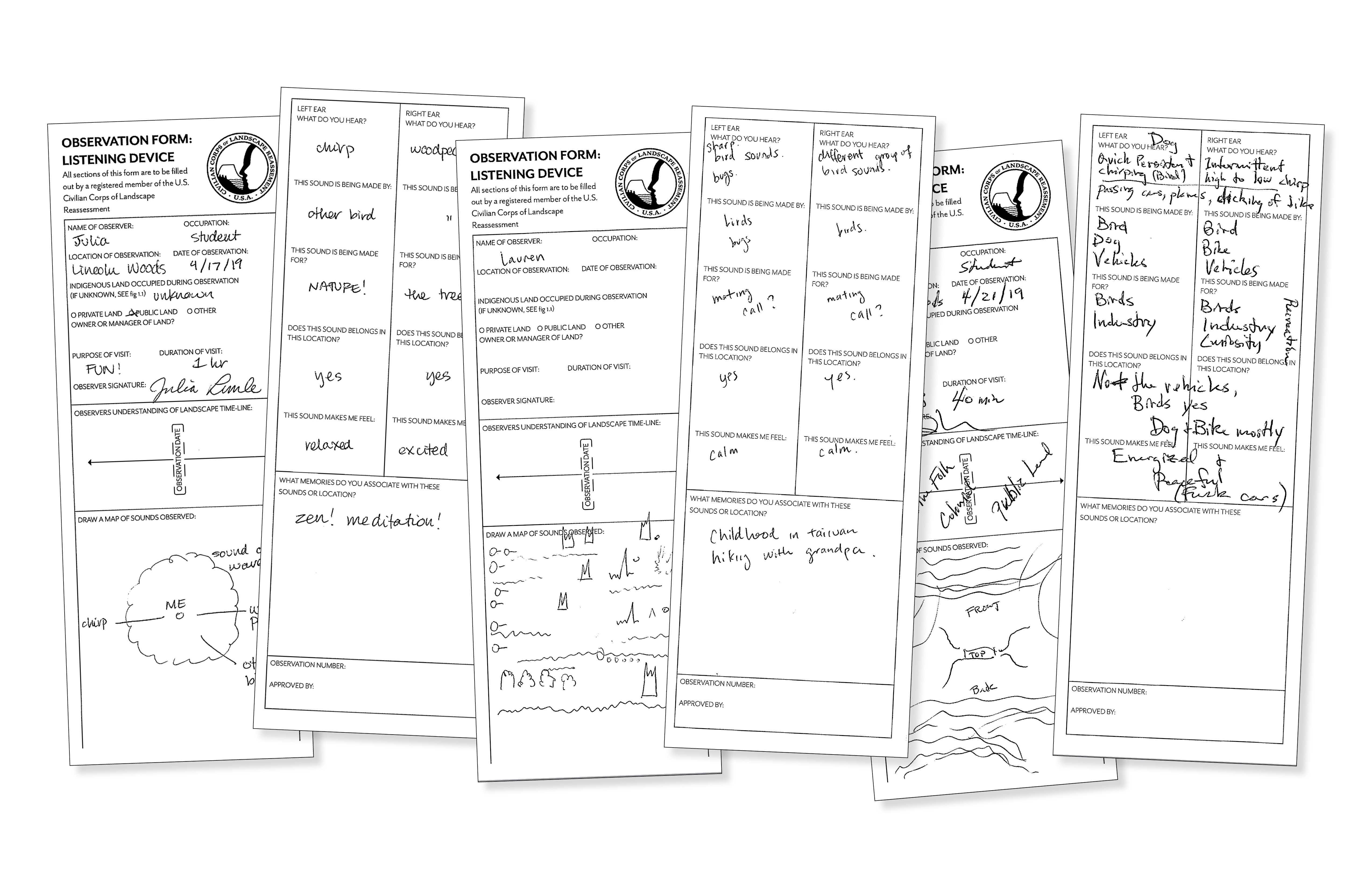
ALL EARS
The soundscapes we interact with help inform our relationship with the land just as much as the visual inputs. Most people can hear birds chirping out of their window and make a few quick deductions about what the day will be like. If birds are singing, it is likely spring or summer, likely warm and sunny, and there is not much wind. We make these conclusions all without ever seeing the bird in the flesh. But much of our soundscape gets overwhelmed with too much input take for granted the individual noises being made around us.. The All Ears Listening Device is a listening device that both amplifies and directs hearing while limiting physical movement. Instead of getting a 360 degree soundscape, the device a soundscape with limits you to two smaller cones of sound from opposite directions. It is with these opposing sound inputs that the users are asked to consider and record. How are these sounds competing with each other? How are they complimenting each other?
The soundscapes we interact with help inform our relationship with the land just as much as the visual inputs. Most people can hear birds chirping out of their window and make a few quick deductions about what the day will be like. If birds are singing, it is likely spring or summer, likely warm and sunny, and there is not much wind. We make these conclusions all without ever seeing the bird in the flesh. But much of our soundscape gets overwhelmed with too much input take for granted the individual noises being made around us.. The All Ears Listening Device is a listening device that both amplifies and directs hearing while limiting physical movement. Instead of getting a 360 degree soundscape, the device a soundscape with limits you to two smaller cones of sound from opposite directions. It is with these opposing sound inputs that the users are asked to consider and record. How are these sounds competing with each other? How are they complimenting each other?
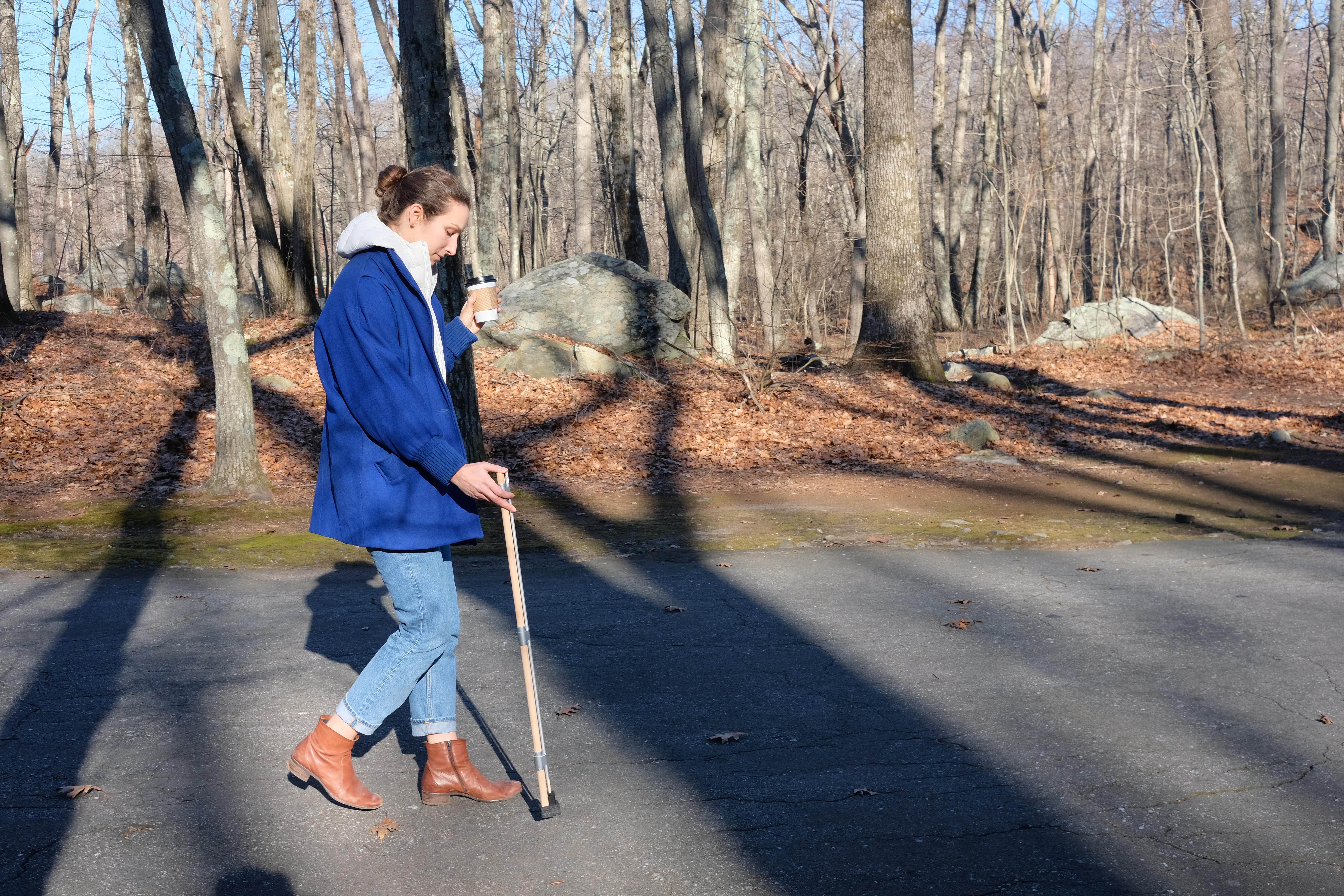
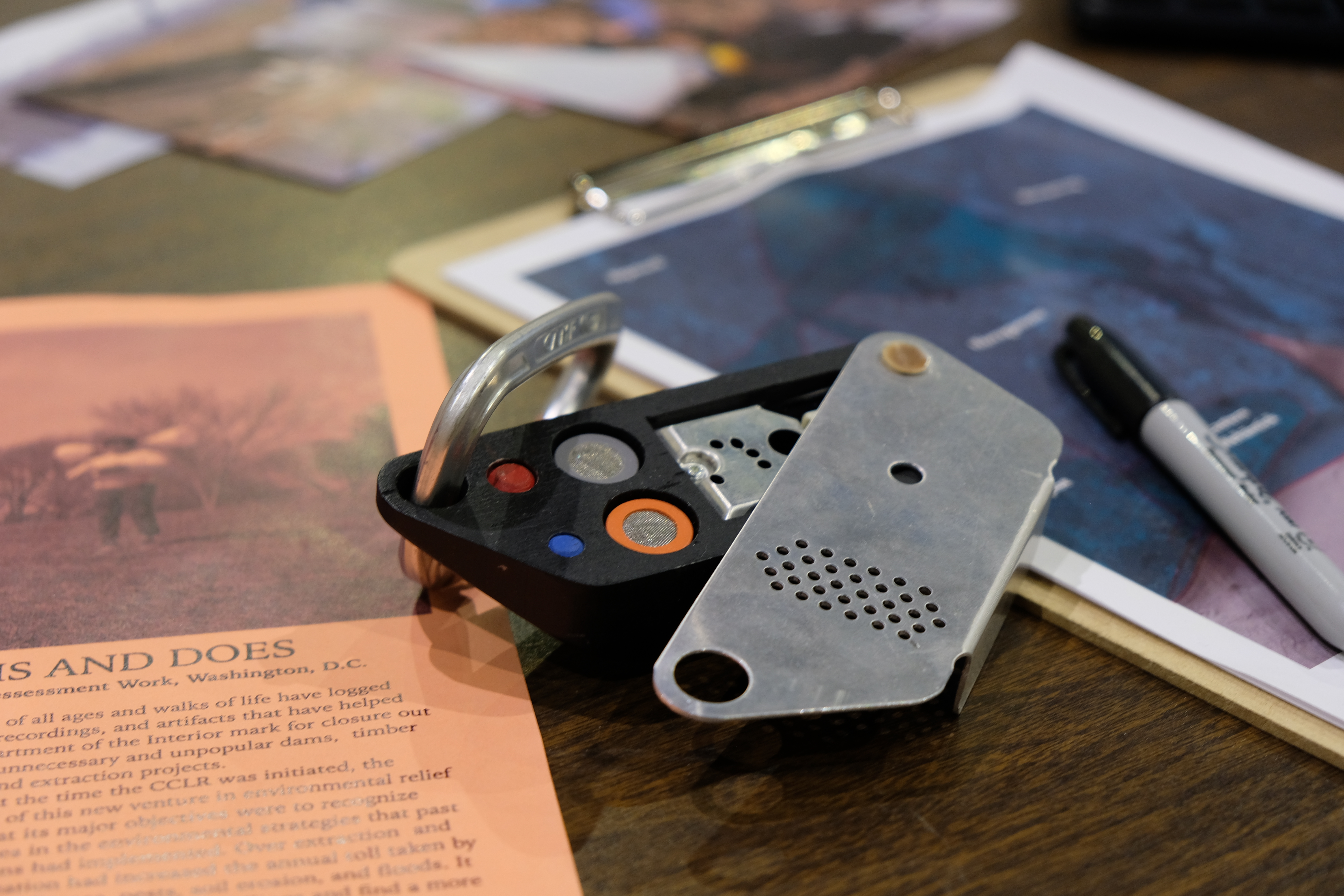
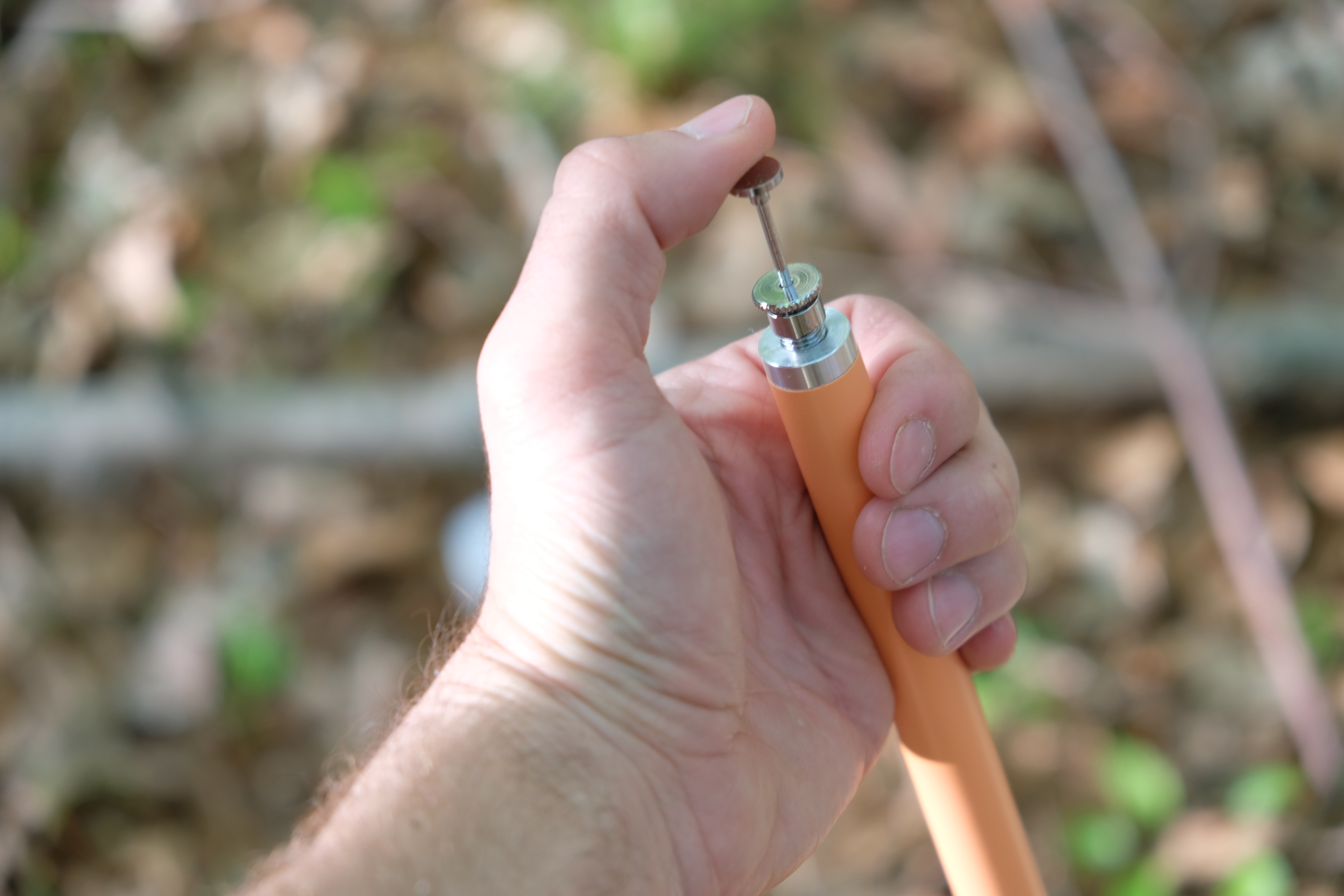
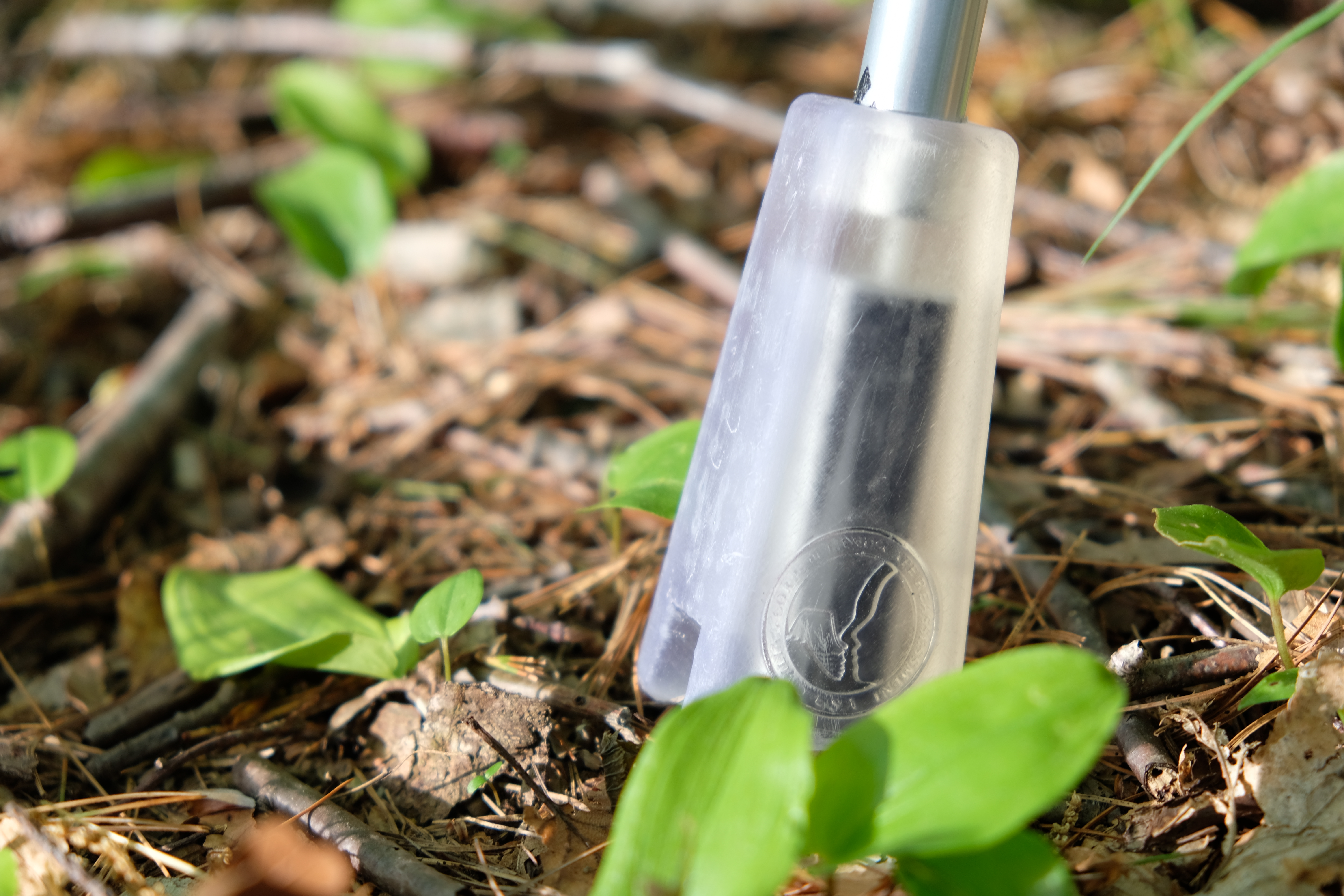
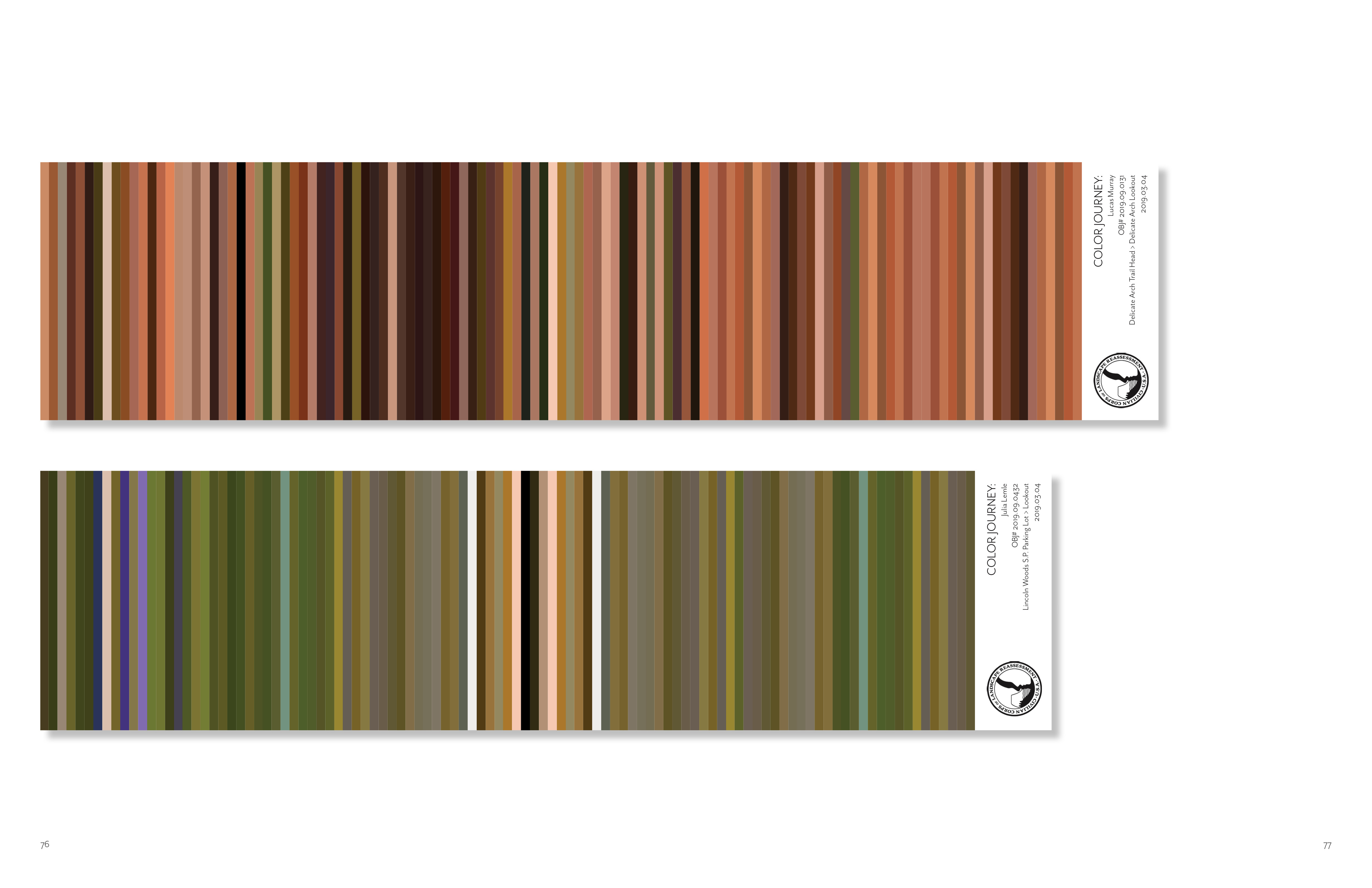
COLOR-TREKKER
Looking to expand on the usefulness of tools that backcountry travelers already use, the Color Trekker is a way to map and catalog your surroundings through color. Taking design cues and functional elements from traditional trekking poles, the Color Trekker also contains a color sensor at its base. When placed against the ground, it is able to record and store the exact color code of the object it is touching. For the Corps, this tool has been used in several ways. Traditionally, to record hike or trip in nature, you would use a map or GPS to track where you have been. Forgoing a direct spatial awareness for understanding a trip, the Corps asks observers to map by color. Every step, take a color reading. Over time you will have amassed a large tapestry of colored bars representing the changing land underfoot. Normally when we go for a walk, we look up to the sky or horizon. But there is beauty in what is directly beneath us. These maps then through color show how terrain can change over a distance. It will expose observers’ unconscious decisions on where they are walking as well as alert park rangers on if they are staying on trail or not. Distance would also be measured in new ways. The physical length of the tapestry would represent the length of your trip and efforts in collecting.
Looking to expand on the usefulness of tools that backcountry travelers already use, the Color Trekker is a way to map and catalog your surroundings through color. Taking design cues and functional elements from traditional trekking poles, the Color Trekker also contains a color sensor at its base. When placed against the ground, it is able to record and store the exact color code of the object it is touching. For the Corps, this tool has been used in several ways. Traditionally, to record hike or trip in nature, you would use a map or GPS to track where you have been. Forgoing a direct spatial awareness for understanding a trip, the Corps asks observers to map by color. Every step, take a color reading. Over time you will have amassed a large tapestry of colored bars representing the changing land underfoot. Normally when we go for a walk, we look up to the sky or horizon. But there is beauty in what is directly beneath us. These maps then through color show how terrain can change over a distance. It will expose observers’ unconscious decisions on where they are walking as well as alert park rangers on if they are staying on trail or not. Distance would also be measured in new ways. The physical length of the tapestry would represent the length of your trip and efforts in collecting.
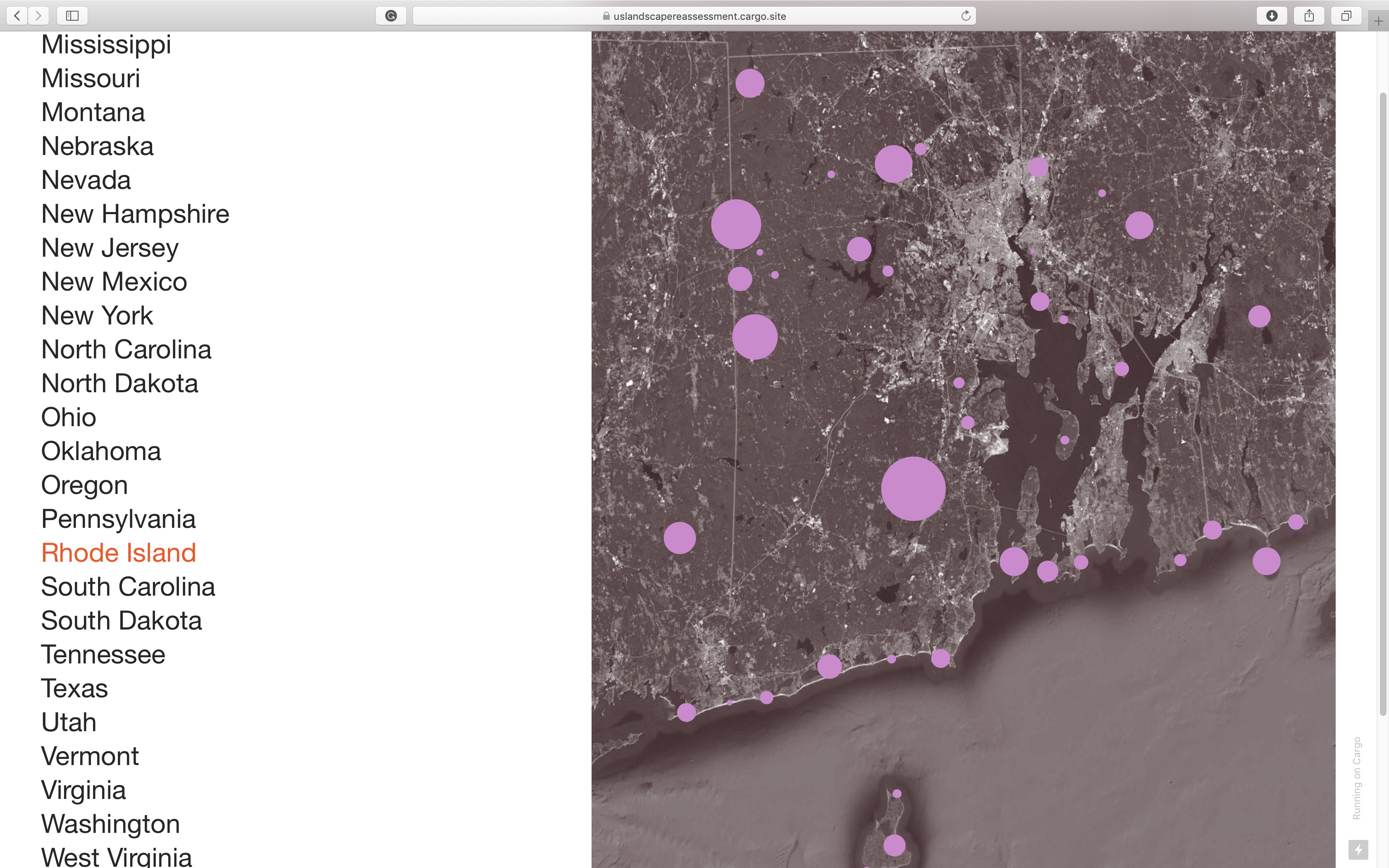
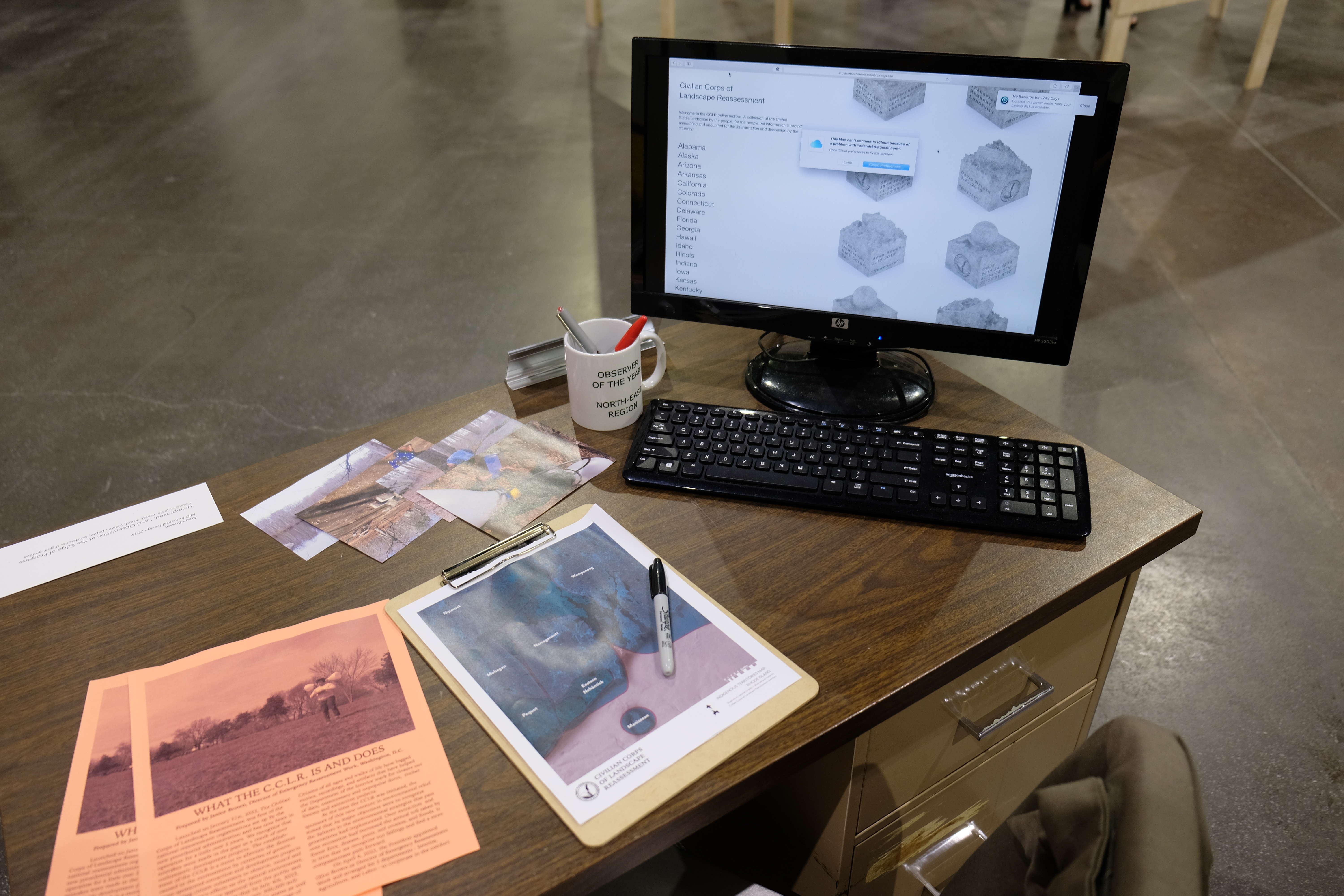
ARCHIVE
The information gathered by the members of the Civilian Corps of Landscape Observation belongs to the people of the United States of America. It is to be aggregated into one central location and will be accessible by anyone in the country. The work of reassessment is a community activity and in order for conversations and connections to arise, the whole community must be able to see the collective fruits of their labor. On a macro scale, this archive will take the form of an online database. All observations will appear in this database in full, with the exception of full names. The online database will not be curated by the CCLR in any way. It is up to local communities to form their own stories based on their collective observation labor. The CCLR will provide ways to search the archive. Potential search strategies include: Location, Date, Land Manager, Tool, Observation density, Observation Type (drawing, story, poem, image, map, model), and Keywords Used.